Manitou Incline Work Day Sept 13, 2014

September 10th, 2014

Manitou Incline to Barr Trail Connector

This Saturday, September 13, will be the first of 3 work days this fall for the Manitou Incline. The other 2 are October 11th and November 1st.

Manitou Incline Repair WorkTimberline Landscaping is doing the hard work on the Incline while it’s closed for repairs through the end of November/early December. They’ve been using a helicopter to move heavy equipment and material up to the steep part of the Incline.

This first work day for volunteers will be on the trail that connects the top of the Incline to Barr Trail. This connector trail has been a social trail with serious erosion issues and multiple paths. The social trails will be closed and a new sustainable trail will be built.

Participants must be 12 years or older, anyone under 18 must have a guardian accompany them during the workday. Check-in/late registration the morning of will begin at 7:30 a.m., in the Barr Parking Lot. The project will begin at 8 AM and end at 3:30 PM. Please come prepared to work the entire day and hike 3 miles up Barr Trail to the project work site.

Tools will be provided and brought to the project work site by staff. You will need to bring and hike with your own gloves, water, hat, sunscreen and lunch.

You can sign up by going to the Colorado Springs Parks and Rec volunteer page and searching with the keyword “incline”. The direct link for the September 13 work day is here

Asolo TPS 520 GV Evo Hiking Boots
Price: $268.44
 
Scarpa Zen Pro Mid GTX Hiking Boots
Price: $159.94
 
Hi Tec Penrith Mid Jr. WP Hiking Boots
Price: $38.73
 

Manitou Incline No Trespassing Sign Photo Opp

February 22nd, 2013

Manitou Incline No Trespassing Sign Removed

The No Trespassing sign was removed from the Manitou Incline the end of January since the Incline became legal to hike on February 1st. The Incline Friends are giving you an opportunity this weekend to get your photo with the Incline No Trespassing sign one last time.

This Saturday and Sunday, February 23rd and 24th, the Incline Friends will have the old Manitou Incline No Trespassing sign at the bottom of the Incline from 7 AM until 11 AM. Donate at least $5 to help with maintaining the Incline and they’ll take your picture alongside the sign.

They’ll e-mail the photo to you or they can use your camera if you like. No limit to the number of people in the shot so bring your friends. This will be your last opportunity to get a photo with the sign and the Incline before it’s retired to the Pioneers Museum.

If you plan on heading up the Incline after getting a photo, be very careful. After a dry winter, the snows the last couple weeks have finally made the Incline snowy and icy. Make sure you have traction devices such as Stabilicers Lite, Yaktrax or Kahtoola Microspikes .

Speaking of the Incline and snow, Roger Austin shared some great photos from this morning’s sunrise on the Incline. I really wish I would have been up there to see it.

Asolo TPS 520 GV Evo Hiking Boots
Price: $268.44
 
Scarpa Zen Pro Mid GTX Hiking Boots
Price: $159.94
 
Hi Tec Penrith Mid Jr. WP Hiking Boots
Price: $38.73
 

UpaDowna Incline Happy Hour

February 7th, 2013

UpaDowna Incline Happy Hour

This is the first Thursday since the Manitou Incline was legalized. This means it’ll be the first legal UpaDowna Incline Happy hour. However until time change next month, the dawn to dusk rule will be broken.

The Incline Happy Hour was started a few years ago by the great folks at UpaDowna. Their motto is “Up a Mountain, Downa a Beer”. Their goal is to get more people in the outdoors.

Now that the Manitou Incline is legal, UpaDowna is encouraging more people to join them. They start at the bottom tie of the Incline (directions) at 6 PM and hike to the top of the Incline.

The hike takes place year round but know your limitations as the Incline can get icy and treacherous in the winter. It’s a self paced hike and not a race. It doesn’t matter what your fitness level. Generally people hang out at the top for a bit and then most head down Barr Trail.

Until time change you’ll need a headlamp to be able to see in the dark. You can also get by with a flashlight but then your hands aren’t free for balance.

Afterwards head to Kinfolks Mountain Shop in Manitou Springs. Enjoy one of the micro brews they have on tap or us hang out with other outdoor lovers. It’s located just east of Ruxton at 950 Manitou Avenue.

Although it’s free to join the Incline Happy Hour, you need to register and sign the waiver on Eventbrite. Not only is it a fun time, but there may be prizes for signing up and staying motivated throughout the year.

Asolo TPS 520 GV Evo Hiking Boots
Price: $268.44
 
Scarpa Zen Pro Mid GTX Hiking Boots
Price: $159.94
 
Hi Tec Penrith Mid Jr. WP Hiking Boots
Price: $38.73
 

Incline Friends Karma Hour

January 14th, 2013

Manitou Incline Christmas Tree

Last week President Obama signed the law clearing up the railway right-of-way issue with the Manitou Incline. The Colorado Springs council also passed the needed resolution for legalizing the Incline for hiking. The only step remaining to legalizing the Incline is a resolution by the Manitou Springs city council. Manitou Springs council is expected to vote on January 29th.

Although I think there are plans to do more than is needed, I noticed several loose ties when I hiked the Incline yesterday. Stabilizing some sections need to be done soon or more work will need to be done. The Incline Friends are tasked with raising money to repair and maintain the Incline.

Total cost to implement the Incline Management Plan will run about $1 million, and the Incline Friends need $200,000 of that by the first week of March to meet a critical grant deadline. They expect much of it to come from private donors, but not all of it.

There are a few ways to help the Incline Friends raise money. Tomorrow night there’s a fun one. The Incline Friends Karma Hour will be at Bristol Brewery (1647 S. Tejon) from 5 to 9 PM Tuesday, Jan. 15. Bristol will donate $1 to the Incline Friends for every pint sold. Click here for more on the Incline Friends Karma Hour.

Other ways to help the Incline Friends is to join them, donate using the donate link on their website or putting money into the tube at the bottom of the Incline.

Below are some photos from hiking the Manitou Incline on December 16, 2012. It has become a tradition for people to hang Christmas ornaments on one of the trees at the top of the Incline. With the dry winter there was very little snow on the Incline itself or Barr Trail in December. With the cold and little snow of the last couple weeks, there was more snow on it yesterday afternoon and more fell overnight.

Asolo TPS 520 GV Evo Hiking Boots
Price: $268.44
 
Scarpa Zen Pro Mid GTX Hiking Boots
Price: $159.94
 
Hi Tec Penrith Mid Jr. WP Hiking Boots
Price: $38.73
 

Manitou Incline Expected to be Legal Next Month

January 4th, 2013

Manitou Incline No Trespassing Sign

After 4 years and much hard work by many people the Manitou Incline is expected to be legal for hiking on February 1st, 2013. The U.S. Senate approved a bill clearing up the railway right of way issue for the Incline late Sunday. Sen. Michael Bennet pushed the bill in the Senate and Rep. Doug Lamborn led the effort in the House where the bill passed back in July.

The Manitou Incline management plan identified 13 key steps to complete before the Incline could be made legal. Now that all of those steps have been taken, the only things remaining are for Colorado Springs and Manitou Springs to pass resolutions making hiking it legal. The Colorado Springs City Council is expected to vote on the resolution at its meeting on Tuesday, Jan. 8. Manitou Springs has indicated it will vote on resolution during a Special Meeting on Tuesday, Jan. 29.

“As we look at closing this chapter of the process with a vote to legalize the Incline from the City of Colorado Springs and the City of Manitou Springs’ City Councils, we can begin the next chapter in our process – improving the Incline,” said Sarah Bryarly, Landscaping Architect and Project Manager for the City of Colorado Springs.

The Incline Friends is the non-profit tasked with fundraising for improving the Incline and have been a big part of legalizing the Incline. Incline Friends will need your help in a major fundraising push. Total cost to implement the plan will run about $1 million and they need $200,000 of that by the first week of March to meet a critical grant deadline. They expect much of this to come from private donors but not all of it.

They’ll start with the Incline Friends Karma Hour, 5 to 9 p.m. Tuesday, Jan. 15 at Bristol Brewery (1647 S. Tejon). Bristol will donate $1 to the Incline Friends for every pint sold.

In the meantime, I’d like to encourage you to join Incline Friends and/or make an online contribution (find the PayPal “Donate” link on the main page of the Incline Friends website.) There’s also a donation tube at the bottom of the Incline that you can throw in a buck or more when you hike the Incline.

Asolo TPS 520 GV Evo Hiking Boots
Price: $268.44
 
Scarpa Zen Pro Mid GTX Hiking Boots
Price: $159.94
 
Hi Tec Penrith Mid Jr. WP Hiking Boots
Price: $38.73
 

Manitou Incline History Exhibit

November 8th, 2012

Manitou Incline 517 Event

The Manitou Springs Heritage Center is having a “517 at 5:17” Event tonight, November 8th at 5:17 PM, for the opening of its newest exhibit titled “The Manitou Incline – From Utility to Attraction”. Some of my Manitou Incline photos are in the exhibit. The exhibit relates the story of how the installation of a pipeline for a hydro-electric plant became a famous tourist amusement for 81 years. Now it’s the most popular hike in the Colorado Springs area even though it’s not legal to hike.

Eric Swab created the exhibit featuring photos and artifacts from 1903 to the current day from his comprehensive research of the Incline. Mr. Swab’s complete Incline history in booklet form will be available for purchase in the Museum Store. In addition, a special compilation video featuring a historic film, a video of the last ride up the Incline, and still photos has been created by Heritage Center volunteer Ashley Swendsen and is a highlight of the exhibit.

“The Manitou Springs Heritage Center is very grateful that Mr. Swab agreed to put together the exhibit,” stated boardmember Michelle Anthony. “Eric is great to work with and does a terrific job; we are fortunate to be able to present exhibits he is involved in.” Colorado Springs Utilities and the Incline Friends board helped financially with the exhibit. Admission to the Heritage Center is free but financial support is still needed to cover exhibit costs, so please consider making a contribution.

The Manitou Springs Heritage Center is located at 517 Manitou Avenue in Manitou. Hours of operation starting November 2nd will be Fridays, Saturdays, and Sundays from 12 to 5 pm. To find out more about the Manitou Springs Heritage Center visit their website at www.manitouspringsheritagecenter.org.

In addition to the Incline exhibit at the Manitou Springs Heritage Center, Eric Swab will talk about the history of the Incline at 11 AM Friday, November 9th, at the Old Colorado City History Center, 1 S. 24th St., Colorado Springs. The title of his talk is “The Manitou Incline – From Drinking Water to Tourism”.

Doors open at 10:30 AM and seating is limited. Historical Society members can attend free and entry for others is $5. Find out more on the Old Colorado City Historical Society website.

Incline Friends Membership Drive

January 24th, 2012

Manitou Incline Friends Logo

Currently making the Manitou Incline legal is progressing well and the Incline could be officially open by summer. The Incline Friends is the group that is raising funds to help implement the Manitou Incline Site Development and Management Plan. They are having a membership drive 6 PM to 9 PM. Wednesday, Jan. 25, at Phantom Canyon Brewery.

Members of the Incline Friends committee will be on hand to provide updated information about the legalization process and where the project currently stands.

Community members are encouraged to join Incline Friends, the nonprofit organization dedicated to raising funds, public education and volunteer coordination for the Manitou Incline. Membership cost is $35 per year. All who join will receive a new Incline Friends tech T-shirt. And Phantom Canyon has promised to buy a beer for the first 50 who join.

If you can’t make it to the membership drive at Phantom Canyon, you can join the Incline Friends online.

Ring The Peak Trail

July 17th, 2011

Ring the Peak Trail

Over the years I’ve ridden my bike around Pikes Peak several times. The route I’ve done the most often has been on my mountain bike up Gold Camp Road and then back the pavement on CO 67 and US 24. From my house that route is over 90 miles. I’ve also done the mega-mile road loop through Divide, Guffey and Canon City and if I remember correctly it is about 170 miles with a ton of climbing.

The Ring the Peak Trail around Pikes Peak is a shorter but true mountain bike or hiking route that has been mapped out. There’s a section missing in the area of the Pikes Peak South Slope reservoir area that requires using CO 67 and Gold Camp Road. Over the last couple years, I’ve had a couple friends ride the Ring the Peak Trail and they’ve all said it was really hard.

I’ve been wanting to ride Ring the Peak but haven’t felt I’ve been in good enough shape to enjoy it. Late last year a mountain bike race on the Ring the Peak Trail was announced and I promptly signed up. Although I was far from in shape, it was more than 9 months away so I’d have plenty of time to train.

Fast forward more than 6 of those months and I’m still not in shape. In between we decided to move to a different house and that has been a long, time consuming ordeal. The Leadville 100 is only a month away, we’re in our new house and I’ve got to get in shape quickly.

So when when Ryan invited me a few weeks ago on a recon ride of the Ring the Peaks Trail so he could get a GPS track for the race, I started thinking about going along. Even though my longest ride this year had only been 4 hours, I found myself in Manitou Springs just after 5:30 AM Saturday July 9th prepared to attempt to ride an expected 10+ hours.

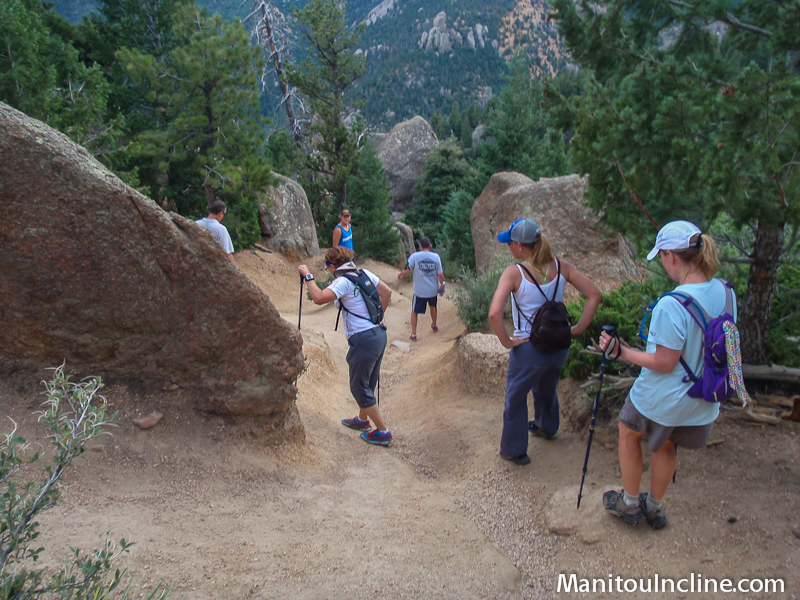
I was running a little late and had underestimated just how bad the parking has become with all the people hiking the Manitou Incline. By the time I figured out where I could park for more than 3 hours and rode up to the Ring the Peaks trailhead, it was nearly 6 o’clock. Unfortunately I had missed Ryan and PJ but could see their fresh tire tracks on the trail. Even though it would have been nice to start with them, I didn’t expect to be able to keep up with them and had planned on riding most of the day by myself.

Soon the UPT trail became a hike-a-bike but it wasn’t long until I was at the top of the steep section. From there the route follows the UPT until dropping down to the gate at US 24 across from the Waldo Canyon trailhead. Fortunately at that time of the morning the traffic wasn’t bad on US 24 and I was in Cascade soon enough.

View from Mount Esther TrailSoon after riding past the turn to the Pikes Peak Highway, it was time to head for higher elevations. After I turned onto Picabo Road, it just kept getting steeper and steeper. By the top I think it was the steepest paved road I’ve been on.

A left turn From Picabo Road on to Mountain Road brought me to the Mount Esther Trail. Mountain Road wasn’t much of a road and looked more like a dirt driveway. Except for a couple very short sections, Mt. Esther Trail was about a 30 minute hike-a-bike that climbed high above Chipita Park.

South Catamount ReservoirThe reward for climbing up Mt. Esther was some great riding through the trees on a mix of singletrack and access roads. I passed Crystal Reservoir and South and North Catamount Reservoirs. A bit of the route used part of the Sand Creek Series Catamount course that I raced back in the mid-90s and hadn’t ridden up there since.

After riding through more beautiful areas, the route popped out onto the graded road just below the Crags Campground. I rode into the campground and used the pump there to get some water. I thought I had at least close to enough water left to get me to the Gillette Flats spring but didn’t want to run out. I only half filled my 100 oz bladder because I didn’t want to carry more weight than I needed to.

In between the Crags campground and the descent from Horsethief Park down to CO 67, there are couple climbs with a fun descent in between. By the 2nd of this climbs, I was definitely feeling the ride and wasn’t too happy to be climbing. It didn’t take long though to get over the top and do the fun descent through Horsethief Park and down to CO 67.

CO 67 is a gradual climb and has quite a bit of traffic with people going to Cripple Creek but isn’t too long. I started feeling a couple twinges of cramps soon after getting to the road. I stopped, took some Endurolytes and sat down for a short break the first time on the ride. After a few minutes, I continued on to the spring along CO 67 and filled up the full 100 ounces.

Cathedral Rocks along Gold Camp RoadFrom there I had a few easy miles on Highway 81 and Gold Camp Road. I spun easy and tried saving some energy because I had an idea of what was coming up.

All too soon I was at the left turn to start up the Beaver Creek access road to the Pikes Peak South Slope reservoirs. I had never ridden it before but I was up it in a car last summer when I hiked on the Pikes Peak South Slope. I remembered it as being steep and the GPS track from Scott Morris’ ride report also showed it as a steep climb.

I stopped to get something from my pack and 2 guys that were bike packing rode by. They told me Ryan and BJ were just behind them. I was surprised to hear that and wondered where I had passed them.

It wasn’t long before I heard someone call my name and looked back to see Ryan with BJ not far behind him. It turned out they had stopped at the KOA on Highway 81 for a snack. Apparently I rode by while they were stopped.

Just after joining with Ryan and BJ, it started raining. It poured but fortunately only for about 5 minutes and the lightening wasn’t too close.

We rode up to the gate that blocks access to the Pikes Peak Slope reservoirs. From there the Ring the Peaks route heads up a steep, washed out jeep road. The bike packers were stopped there and we all took a short break.

Pikes Peak from Old Seven Steps RoadThen we started the hike-a-bike on up to the 11,300 high point. I was feeling low on energy and as we went up the other 4 slowly pulled ahead. Then I totally bonked and it was all I could do to keep moving forward. As I neared the top, it wasn’t as steep and I should have been able to ride but it was all I could do to just walk. Once over the top, it was a quick descent down to Elk Park.

Just after starting the short climb up from Deer Park to the Almagre Road, I meet a big Ram truck coming toward me on a narrow rocky section. He stopped so I could go by but the truck pretty much took up the whole road. I thought I could ride up on the bank a little to get by.

My rear wheel slid out when I was halfway past the truck. I had trouble un-clipping and pretty much fell over before I got out of my pedals. Just as I slid out, the guy decided to pull forward to try giving me more room. I watched in horror as my rear wheel slid in front of his back wheel and he rolled on to it.

He saw it happening and stopped. There I sat squatting on the bank of the road looking at a big, heavy truck with it’s back wheel covering my tire, rim and a couple inches of my spokes on the edge farthest from me. I had the guy back up so he wouldn’t drive over more of my wheel.

I was amazed to see that my rim wasn’t crushed but didn’t know how much it would be bent. I pulled the bike up and gave the wheel a spin. It had a pretty good wobble to it but not bad enough for the tire to hit the rim. The guy felt really bad and I think would have given me a ride but I told him I thought I’d be able to ride it.

I was a bit cautious as I started riding but everything felt Ok. It wasn’t long until I was up to the Almagre Road and ready to start descending nearly 5,000 feet to town below by way of the Jones Park downhill.

It didn’t take long until I was down to the 701 trailhead. A thunderstorm was moving in and lightening was closer than I liked. I had thought maybe the other 4 guys would wait at the trailhead but wasn’t surprised to see they were gone with the storm so close.

Columbin Along Cheyenne CreekAlthough one way to get to Jones Park is to stay on the 701 trail, the Ring the Peak route quickly turns onto the 668 Trail for some steep descending. The 668 Trail then becomes the Pipeline Trail and is fairly flat most of the way over to Jones Park. Once at Jones Park, the trail turns downhill again on Captain Jacks and then on down the 666 Trail to High Drive.

After going a short distance down High Drive, the Ring the Peak Trail turns onto the Palmer Trail and then uses Section 16 and Intemann over to Manitou. The Ring the Peak 100(ish)k race can’t use this section and so we weren’t planning to ride it. I had nothing left in my legs for it anyway and was happy to continue down to Old Colorado City and then spin easily back into Manitou Springs.

It certainly was an epic day on the mountain bike and every bit as tough as I’d been hearing. I ended up with almost exactly 65 miles and 9 hours and 40 minutes of ride time on the GPS. It kept auto pausing on the hike-a-bike sections so I was probably moving a little more time than that. Total elapsed time was nearly 11.5 hours. Cumulative climbing came in at 10,885 feet.

I’ve put the Ring the Peak map and elevation profile over here.

Related Links:

Asolo TPS 520 GV Evo Hiking Boots
Price: $268.44
 
Scarpa Zen Pro Mid GTX Hiking Boots
Price: $159.94
 
Hi Tec Penrith Mid Jr. WP Hiking Boots
Price: $38.73
 

Assault on the Peak in 3D

February 14th, 2011

The inaugural Assault on the Peak, the bike ride from Manitou Springs to the summit of Pikes Peak, was filmed in 3D by Convergent Design. I talked to the 2 guys shooting the video briefly at Crystal Reservoir. They said they were shooting it to show off some 3D capability which I’m guessing is their nano3D product.

I don’t have any 3D glasses laying around so I’m not sure how it looks in 3D. If you have some blue and red 3D glasses, take a look at it and leave a comment below with your thoughts.

Unfortunately it doesn’t look they got any footage from above timberline. In the version I embedded above, Peak Region Cyclist added in a few still photos.

Registration for the 2011 Assault on the Peak opens tomorrow and has a reduced entry price of $150 through April 30th. After that it will be $180 and day of ride registration will be $200.

Related Links:

Asolo TPS 520 GV Evo Hiking Boots
Price: $268.44
 
Scarpa Zen Pro Mid GTX Hiking Boots
Price: $159.94
 
Hi Tec Penrith Mid Jr. WP Hiking Boots
Price: $38.73
 

Manitou Incline Open House Tomorrow

January 19th, 2011

Manitou Incline No Trespassing Sign

The long climb to legalizing hiking the Manitou Incline is taking another step tomorrow, January 20. There will be an open house about the draft Manitou Incline management plan from 5 to 7 p.m. at Manitou City Hall, 606 Manitou Ave. Instead of a presentation, there will be stations that cover the various topics of the management plan.

I haven’t found info on what changes they’ve made to the draft Manitou Incline plan since it was presented in October. The 2 most unpopular rules were only allowing hiking from dawn to dusk and no dogs. Also those at the October meeting didn’t feel the plan really had any plan to address the parking issues.

I’ve been told that the main fundraising for money to repair and maintain the Manitou Incline will be done through the Incline Friends group. The Trails and Open Space Coalition is facilitating creating the Incline Friends. It is free to join the group. E-mail This e-mail address is being protected from spambots. You need JavaScript enabled to view it
or call at 719-633-6884.

The friends group needs volunteer help in these areas:

  • Leadership and Coordination
  • Fundraising
  • Partnerships and sponsorships
  • Grantwriting
  • Education/Outreach
  • Volunteer coordination
  • Maintenance and Construction – physical labor on the Incline.

The open house tomorrow isn’t the final meeting. The recommended plan will also be presented at the public meetings of various appointed and elected bodies of Colorado Springs and Manitou Springs over the coming two months before it will hopefully be approved by the landowners later this spring. The other planned meetings are:

  • TOPS Working Committee: February 2, 7:30 a.m. Parks, Recreation and Cultural Services Department, 1401 Recreation Way
  • Parks and Recreation Advisory Board: February 10, 7:30 a.m. Parks, Recreation and Cultural Services Department, 1401 Recreation Way
  • Colorado Springs City Council: February 22, 1 p.m. Colorado Springs City Hall, 107 N. Nevada Avenue
  • Manitou Springs Planning Commission: March 9, 7 p.m. Manitou Springs City Hall, 606 Manitou Avenue
  • Manitou Springs City Council – TBA.

Asolo TPS 520 GV Evo Hiking Boots
Price: $268.44
 
Scarpa Zen Pro Mid GTX Hiking Boots
Price: $159.94
 
Hi Tec Penrith Mid Jr. WP Hiking Boots
Price: $38.73


Email: web@ultrarob.com

Business Seal       Privacy Seal