Hiking Legend Gone

April 30th, 2010

I hiked with Peggy Parr for the first time in 1993. It was April, and Cheyenne Canyon’s trails were still clogged with thigh-deep snow. There were five women who formed a loosely organized hiking group with Peggy, and I had been invited to write a story for The Gazette about the group’s treks. We post-holed through the deep snow, covering seven miles in about four hours. We had a six-minute lunch break. Afterward, Parr said she “took it easy” on me because we had never met before and she wasn’t sure about my hiking stamina.

She was 70 then and I was …much younger. And she kicked my butt. We hiked many more times over the next decade and each time, Peggy entertained with a story or two, including her chance encounter with a naked hiker on the Barr Trail and her discovery of a dead body that had been thrown over the side of Gold Camp Road (when she was a member of El Paso County Search and Rescue).

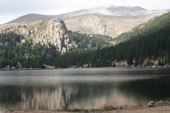
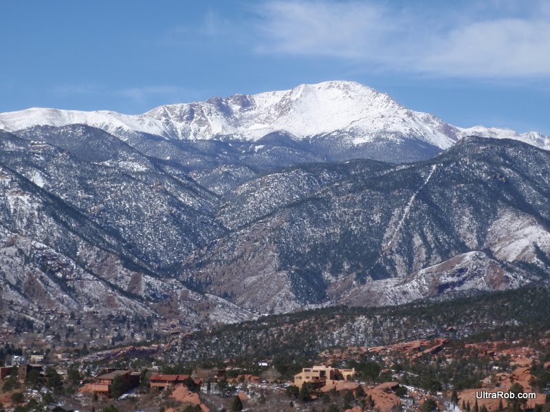
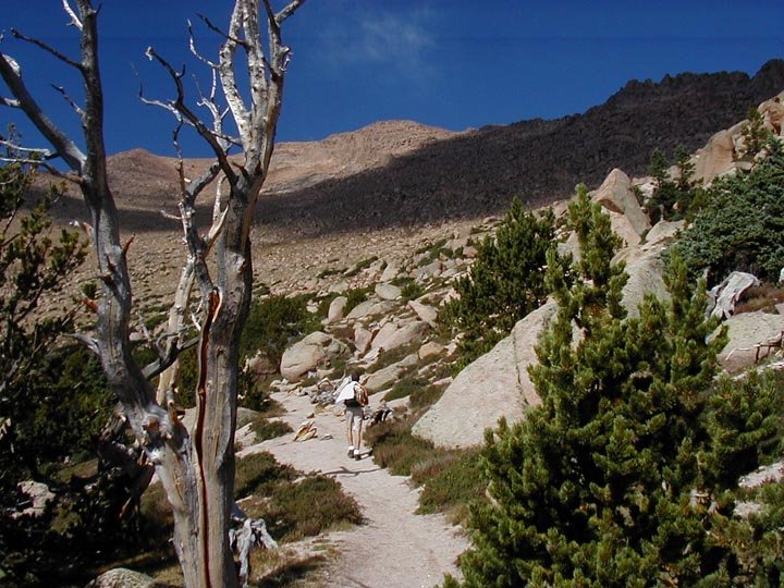
But Peggy never talked much, and was frankly and openly annoyed by hiking groups that she determined too chatty for her tastes. She lived near Cheyenne Canyon, and that was where she could be found much of the time. But she also treasured Barr Trail and spent many days there, stopping only for short breaks at the Lunch Tree (remember the Lunch Tree?) on the way up or down.

She told me once that she only felt her age when she looked in the mirror, and that when that happened, it was “quite shocking.”

But she was philosophical about aging and hiking, and told me for a story that ran in The Gazette, “As the hiker picks up age, he can still hike quite fast and quite far but he doesn’t want to. He has gotten some wisdom with his years. He walks along, and stops to pause and see the woods.”

Peggy died April 2 at age 87.

Deb Acord

Hi Tec Penrith Mid Jr. WP Hiking Boots
Price: $38.73
 
Adidas AX2 Mid GTX Hiking Boots
Price: $135.00
 
Salomon X Alp Mid LTR GTX Hiking Boots
Price: $219.95
 

Mark Your Calendars for a South Slope Trip

April 20th, 2010
Boehmer Reservoir with Pikes Peak in the background (CSU photo)

Would you pay to explore Pikes Peak’s South Slope? Last week, the Colorado Springs City Council voted to finally allow public access on the part of Pikes Peak that contains the city’s watershed. That plan involves some sort of fee system, which has yet to be worked out.

Colorado Springs Utilities owns and manages the South Slope, which has been the subject of endless debates, surveys, public meetings, and consultant presentations for more than a decade. And until recently, those who have lobbied and worked for access to the remote area had all but given up.

Eight years ago, Gazette columnist Barry Noreen and I embarked on a project that explained the South Slope to readers. Its opening looked promising, because CSU had finally completed a master plan that included recreational options.

In that article, one trails advocate was asked why the public should have access to this area closed for decades. “Why?” Mary Burger said. “Because we own it.”

But that master plan gathered dust, and it seemed unlikely that those who worked on the plan, and even their children and grandchildren would ever be able to explore the area.

Burger is the founder of Friends of the Peak, a group formed in 1995 to work on erosion control projects on other parts of the mountain, but members of the non-profit have been interested in, and involved with, the South Slope since 1998.

Today, Burger is celebrating the surprising announcement that the South Slope will finally be opened to recreation, and that Colorado Springs Parks, Trails and Open Space department will manage it.

Just how they will manage it is still being figured out, but it will probably involve a fee system that would circumvent using tax dollars on it.

Guided tours could begin as early as June. I can’t wait. But the question remains: Would you pay to get onto the South Slope?

If you want more information, a public meeting is planned at 5 p.m. April 27 at the Leon Young Service Center, 1521 Hancock Expressway. The final plan will be released then.

Deb Acord

Note from UltraRob: From what I’ve heard, mountain biker comments on the Pikes Peak South Slope plan presented in January had an impact and bikes will be allowed on the trails originally designated no bikes allowed. I’d encourage everyone intested in access to this area to go to the meeting and give their feedback on the latest plan.

Related Links

Hi Tec Penrith Mid Jr. WP Hiking Boots
Price: $38.73
 
Adidas AX2 Mid GTX Hiking Boots
Price: $135.00
 
Salomon X Alp Mid LTR GTX Hiking Boots
Price: $219.95
 

Ride Your Bike Up Pikes Peak Highway

April 1st, 2010

Update: I’ve posted Pikes Peak Assault photos.

Update: The Pikes Peak ride has been lengthened and the price reduced. Click here for details.

Registration opened today for the new Assault in the Peak bike ride. It’s a non-competitive ride up the entire Pikes Peak Highway to the summit of Pikes Peak on Sunday, August 29th. Normally bikes aren’t allowed on the road. The promoter has rented the highway for the day so there will be no cars.

The ride starts at 7,750 feed at finishes at 14,110. That makes a gain of 6,360 feet in 18.47 miles. The average grade is 6.7% with the steepest grade at 10.5%. This compares to Mount Evans climbing 6,575 feet over 27.4 miles.

Although much of the road used to be gravel, they’ve been paving a bit more of it each summer. So much gravel was washing off the road that it was causing environmental issues. By the time of the ride they expect only 2.5 miles to be gravel.

There used to be a mountain bike race to the summit that I did several times. That race started at the old ski area and only did the top 8 miles with 3210 feet of climbing. The closest I’ve come to riding all the way is when I rode from Crystal Reservoir to the summit. That’s about 12 miles with 4900 feet of climbing. It’s certainly a very cool ride to do.

So what happens once you make it to the top? Riders will be allowed to ride down the mountain in controlled groups, secure a seat in one of the downhill vans or ride the Pikes Peak Cog Railway down the other side of the mountain. I’m not sure how riding the Cog will work since it’s normally hard to get a one way ticket and I assume you’ll have to pay for it.

Registration is through BikeReg and is limited to the first 1500 riders. The ride isn’t cheap and will set you back $180. I’m sure renting the highway for the day isn’t cheap and they will have aid stations along the way, time everyone and take warm clothes to the summit.

Riding 18 miles uphill isn’t for you? Challenge unlimited has a permit to do guided rides down Pikes Peak throughout the summer. They take care of getting you to the top and includes bike and helmet. It costs around $100 depending on time of day and size of group.

UltraRob

Hi Tec Penrith Mid Jr. WP Hiking Boots
Price: $38.73
 
Adidas AX2 Mid GTX Hiking Boots
Price: $135.00
 
Salomon X Alp Mid LTR GTX Hiking Boots
Price: $219.95
 

Pikes Peak South Slope Meeting January 2010

January 29th, 2010
Boehmer Reservoir with Pikes Peak in the background (CSU photo)

Update: At the meeting the end of April, they presented a mostly final Pikes Peak South Slope plan that included several things that were brought up in this meeting.

The Pikes Peak South Slope recreation meeting on Tuesday was very well attended. I counted somewhere close to 130 people.

There weren’t any major surprises from what I wrote before the meeting based on what I had heard. After writing that I also obtained a copy of the concept plan.

The written plan doesn’t have any information in it about who’s going to pay to build the trails and parking lots or how it’s going to be maintained. It turns out that’s because they really don’t have a plan. It did seem pretty clear that it’ll include user fees and could include a private company managing it.

Tom, the presenter, said they want to phase in access and trails because they don’t want to rush and damage a sensitive area. Barry from the Gazette said that we’re already 11 years into the process and he didn’t feel there was any danger of rushing into it. He also brought up that the Denver Water Board also manages recreational access to similar areas.

The reason given for not having a plan that would include a section of the Ring the Peaks Trail was that the Forest Service doesn’t want a new trail. CSU doesn’t want to build a trail that would deadend at the Forest Service boundary. Although I think the Forest Service is reluctant to build the trail, it seems they’re both pointed at the other and using it as an excuse rather than working together.

Their main reason for restricting mountain bikers is the bighorn sheep. There’s believe to about 200 sheep in the area. Utilities was told by a biologist that the speed of bikes scares the sheep. They didn’t know if there were studies showing that. Jim from Medicine Wheel pointed out a study in Canyonlands referenced on the IMBA site that showed that hikers caused significantly more severe responses from desert bighorn sheep than mountain bikers.

I don’t know how the response is similar between desert sheep and our high country bighorn sheep. Still it seems that they are using the sheep as a way to keep mountain bikes out and possibly don’t have sufficient scientific data to back it up. Maybe the area should just be closed to all users during the lambing season.

The main recreation groups of hikers, mountain bikers, equestrians and fishers were well represented. There were also a few rock climbers, hunters. When they asked for who was there for the various types of recreation, it looked like over half the room raised their hands for both mountain biking and hiking. That’s not surprising since there’s a lot of people that do both. Equestrians represented about 20% with a smaller number of fishermen.

Most of the equestrians were happy with the initial plan. I didn’t get a good feel for how hikers felt other than being disappointed about the Ring the Peaks Trail. Mountain bikers definitely weren’t happy about not getting access to the South Slope reservoir area.

If you didn’t make the meeting but want to make comments, fill out the comment form due by February 26th. There’s information on the Watershed Access Project page for emailing it to CSU. They plan to have another public meeting in April with plan refinements based on the feedback they receive. They plan to finish up the planning phase by June.

UltraRob

Hi Tec Penrith Mid Jr. WP Hiking Boots
Price: $38.73
 
Adidas AX2 Mid GTX Hiking Boots
Price: $135.00
 
Salomon X Alp Mid LTR GTX Hiking Boots
Price: $219.95
 

Pikes Peak South Slope Access Plan Meeting Tomorrow Night

January 25th, 2010
View from Pikes Peak

Since 1999 there have been several meetings to discuss public access and recreation on the South Slope of Pikes Peak. Colorado Springs Utilities has seven reservoirs fed by Pikes Peak snowmelt and rainwater on the South Slope. The area has been closed to the public since 1913.

Deb Acord has had the good fortune of seeing it for herself. She visited it several times with CSU escorts in 2002 when she was reporting on this plan for the Colorado Springs Gazette. She says, “Ever since then, I’ve been hoping for the day when I could explore this tangle of deep forests on my own.”

Colorado Springs Utilities has been soliciting input from stakeholders and members of the public for months. Now CSU is ready to present its latest proposed conceptual plan for recreation in the area. Tomorrow evening, Tuesday January 26th, there will be a meeting from 5:30 to 7:00 PM to discuss the latest plan. It will be held in the Pikes Peak Room of the Leon Young Service Center, 1521 Hancock Expressway.

It sounds like mountain bikers may be being kept out of the best part of the south slope. Someone that has seen an initial draft of the proposal says that there are new trails in 2 areas.

One of them is in the area I most think of as the South Slope. There will be access from Gold Camp road to several of the lakes and include a loop trail. Unfortunately this area will be open to hikers and equestrians but not mountain bikers.

This area is key in completion of the 63 mile Ring the Peak Trail. If you follow the link, you’ll see a missing section of the trail and it’s my understanding that this is the area where mountain bikes wouldn’t be permitted. I believe that’s a huge mistake. I don’t have enough details to know if the proposed trail will provide the necessary Ring the Peaks Trail connection for hikers either.

The 2nd proposed trail will provide a connection from Jones Park to the Barr Trail area around the Mount View Trail. Although this isn’t needed for the Ring the Peak Trail as it’s currently defined, it would allow for some interesting loops. Currently there’s really no way to connect by trail between the Cheyenne Cañon/Bear Creek Canyon area and areas near Barr Trail other than dropping to the Intemann Trail.

If you live in the Pikes Peak region and care about our trails, I’d suggest you go to the meeting tomorrow and give your feedback. If you’re a local mountain biker, you really need to be at the meeting and let your voice be heard if it’s true that they’re proposing no mountain bikes in the South Slope reservoir area.

Update: I’ve uploaded a copy of the Pikes Peak South Slope Access Plan. The reasons it gives for restricting mountain bikes is “to allow for a wilderness like experience and to reduce the risk of fast moving recreation impacting bighorn sheep.” With my initial quick look, I also don’t see that the plan will allow completion of the Ring the Peaks Trail.

UltraRob

Related Links

Hi Tec Penrith Mid Jr. WP Hiking Boots
Price: $38.73
 
Adidas AX2 Mid GTX Hiking Boots
Price: $135.00
 
Salomon X Alp Mid LTR GTX Hiking Boots
Price: $219.95
 

Barr Trail Makes “Dangerous” List

November 9th, 2009

photo courtesy PikesPeakCam.com

In its most recent issue, Backpacker magazine lists “The Ten Most Dangerous Hikes in America.” Some of the entries aren’t surprising: the brutally hot Bright Angel in the Grand Canyon, the well-named Maze in Utah.

The list also includes Barr Trail. For those who are constantly frustrated by the bad rap Barr often gets – “it’s a sidewalk;” “it’s among the easiest 14er hikes” – the idea that Barr is really a badass might be good news.

But lightning is the dangerous reason Barr made the list, and it’s always been a component in any hike on Pikes Peak.

My scariest hike on Barr occurred a few years ago during an early September thunder/snowstorm. I was leading a group of friends, all first-timers to the trail, from the summit back down to Barr Camp where we had booked the guest cabin for the night.

Storms weren’t forecast, and skies were uniformly gray when we left the summit, but about two miles down, it started snowing and thundering. When one of my friends asked innocently, “why are the (metal) trail signs humming?” I knew we were in trouble. We spread out and kept moving downhill and made it to the cabin unscathed. (That hike is forever known by my clever friends as “the day Deb tried to kill us.”)

Turns out we did a couple of things right – we started in the morning, when there is (usually) a lower risk of storms, and we spread out when the storm started. But when you’re above tree line on Pikes Peak in a lightning storm, it’s nearly impossible to make yourself follow the other conventional lightning safety tips: take off your pack and move away from it; crouch down and balance on the balls of your feet.

Instead, the impulse is to flee, which takes a while on Barr (unless you’re Matt Carpenter).

Deb Acord

Hi Tec Penrith Mid Jr. WP Hiking Boots
Price: $38.73
 
Adidas AX2 Mid GTX Hiking Boots
Price: $135.00
 
Salomon X Alp Mid LTR GTX Hiking Boots
Price: $219.95
 

Pikes Peak South Slope Redux

September 29th, 2009
Pikes Peak Area Trail

In 1999, a series of public meetings to gather input on opening Pikes Peak’s south slope to recreation was attended by eager outdoor enthusiasts. Using input from those meetings, a sweeping master plan for the entire mountain, including the south slope, was completed in 2000.

So why were residents streaming into a hot conference room at the Leon Young Service Center Tuesday night, 10 years later, to discuss the possible opening of the mountain’s south slope? This meeting was organized by Colorado Springs Utilities, the department in charge of the south slope and its collection of seven reservoirs fed by Pikes Peak snowmelt and rainwater.

The original plan was never implemented, resulting in this eerily similar gathering. “Wow. Déjà vu,” said one person attending.

Those who were at this meeting were hesitant to guess when or even if they would ever explore the south slope trails. Some utilities employees believe a 2012 opening could be possible. Others are more pessimistic, remembering the 25-year wait for the opening of the North Slope. And still others recall that disasters such as the terrorist attacks of 9-11 and the Hayman fire of 2002, both of which were used as excuses by CSU to keep the gates locked, could occur.

But still, the overall mood was of subdued optimism. Even though the south slope has never opened, advocates for its expanded use aren’t giving up. A citizen advisory board has been working for several months on the new Colorado Springs Utilities Watershed Access Plan.

Another public meeting is planned for January, 2010. And CSU is still gathering input about how the south slope should be used recreationally. Should there be camping? An overnight hut system? Rock climbing? Fishing? If you missed this meeting, let CSU know your feelings about this hidden treasure by calling 448-4800 or checking on plan updates at csu.org

Deb Acord

Hi Tec Penrith Mid Jr. WP Hiking Boots
Price: $38.73
 
Adidas AX2 Mid GTX Hiking Boots
Price: $135.00
 
Salomon X Alp Mid LTR GTX Hiking Boots
Price: $219.95
 

Pikes Peak by Moonlight and Snow Storm

February 24th, 2008

Pikes Peak Summit

Chris and I successfully summited Pikes Peak after hiking all Friday night. We had several hours of great moonlight followed by a snow storm. Instead of the round-trip taking our planned 12 hours, it took us 17.5 hours. By the time I got a nap, I had been up for 34.5 hours.

Related Link: Chis’ hike report

Hi Tec Penrith Mid Jr. WP Hiking Boots
Price: $38.73
 
Adidas AX2 Mid GTX Hiking Boots
Price: $135.00
 
Salomon X Alp Mid LTR GTX Hiking Boots
Price: $219.95
 

Technorati Tags: | |

Need a Giant Last Minute Christmas Tree?

December 23rd, 2007

View of Pikes Peak from Work

My new job is going well. There’s one thing though that I’d like improved. My view could be so much better. The top picture is the view from where I sit at my desk. The 2nd picture is the view if I move a few feet.

The tree outside the window would make a great Christmas tree and then my view of Pikes Peak wouldn’t be blocked. If you could use it, I can give you directions. It does look good from outside so I’m guessing the property management wouldn’t be happy if it disappeared.

Hi Tec Penrith Mid Jr. WP Hiking Boots
Price: $38.73
 
Adidas AX2 Mid GTX Hiking Boots
Price: $135.00
 
Salomon X Alp Mid LTR GTX Hiking Boots
Price: $219.95
 

Technorati Tags: |

Colorado Springs and Pikes Peak Region Trails

October 21st, 2007

Barr Trail
Out There has launched a new trail resource for Colorado Springs and the Pikes Peak Region. They’ve also included some trails from the surrounding area. We have more and better trails than even most people in Colorado realize.

They’ve taken the Happy Trails that have appeared on Fridays in the Out There section of the Gazette and made them searchable online. You can select by area or difficulty. According to their blog post you’re supposed to be able to select by specialty (biking, hiking with kids, cross country skiing, etc.) but I don’t see it as a choice. You can type those things in the trail search box and get matching trails. They have added topo maps and hope to eventually include GPS waypoints.

I believe one of the guys behind singletracks lives here although I’ve never met him. In any case there are a lot of the good local trails listed. It’s a mountain biking site but some of the information would be useful to hikers and runners.

Medicine Wheel has a few mountain biking trails online. They have a short description and include GPS file and maps made with TopoFusion.

MapMyRide and MapMyRun have GPS uploads of local trails too. The problem with most trails on MapMyRide and MapMyRun is they don’t really provide much information other than the GPS route.

Some other resources for hikes in the Pikes Peak region are Colorado Guy and LocalHikes. There’s also Trails.com. It’s a subscription site but you can sign up for a 2 week free trial.

Hi Tec Penrith Mid Jr. WP Hiking Boots
Price: $38.73
 
Adidas AX2 Mid GTX Hiking Boots
Price: $135.00
 
Salomon X Alp Mid LTR GTX Hiking Boots
Price: $219.95


Email: web@ultrarob.com

Business Seal       Privacy Seal