
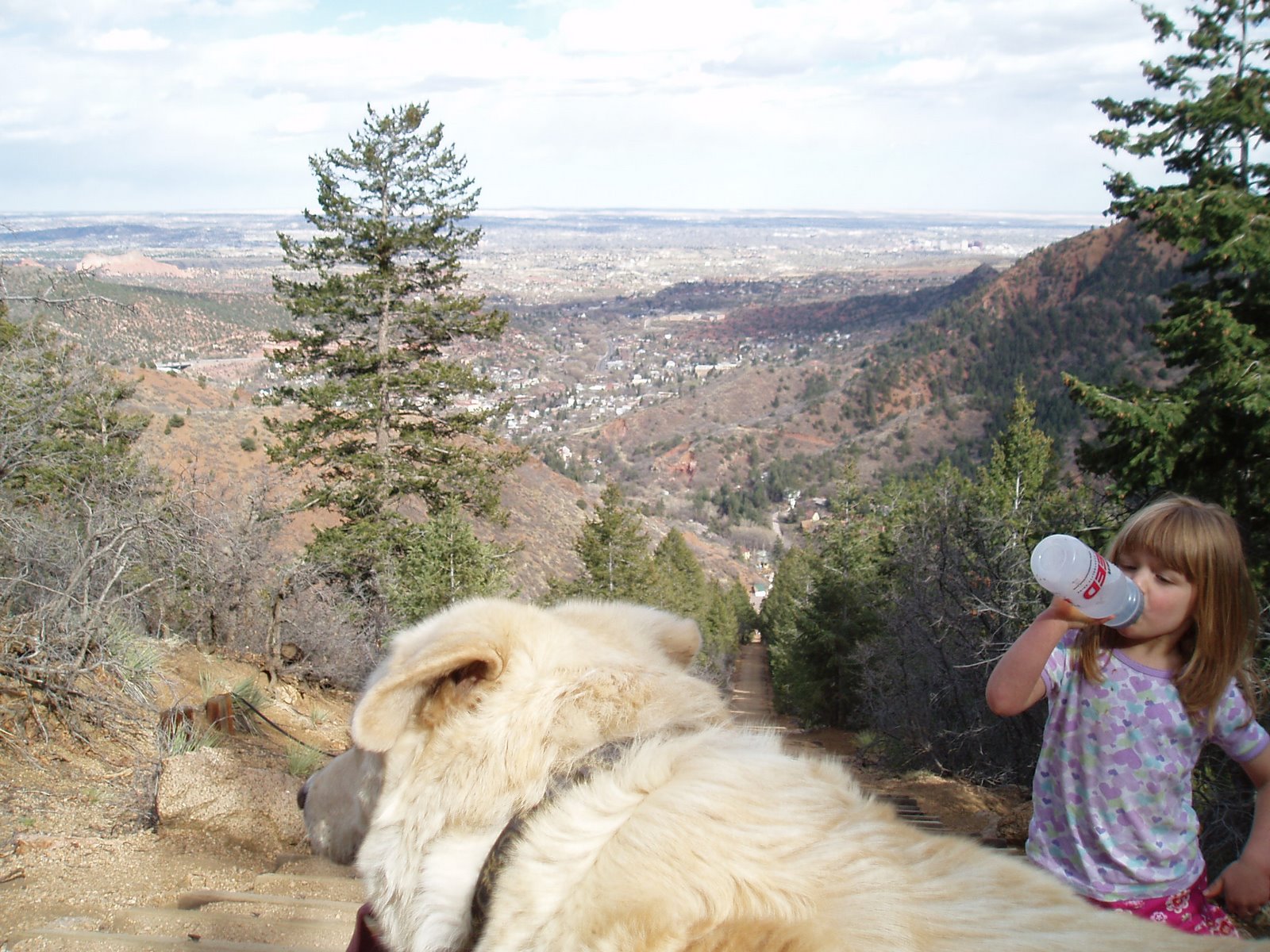
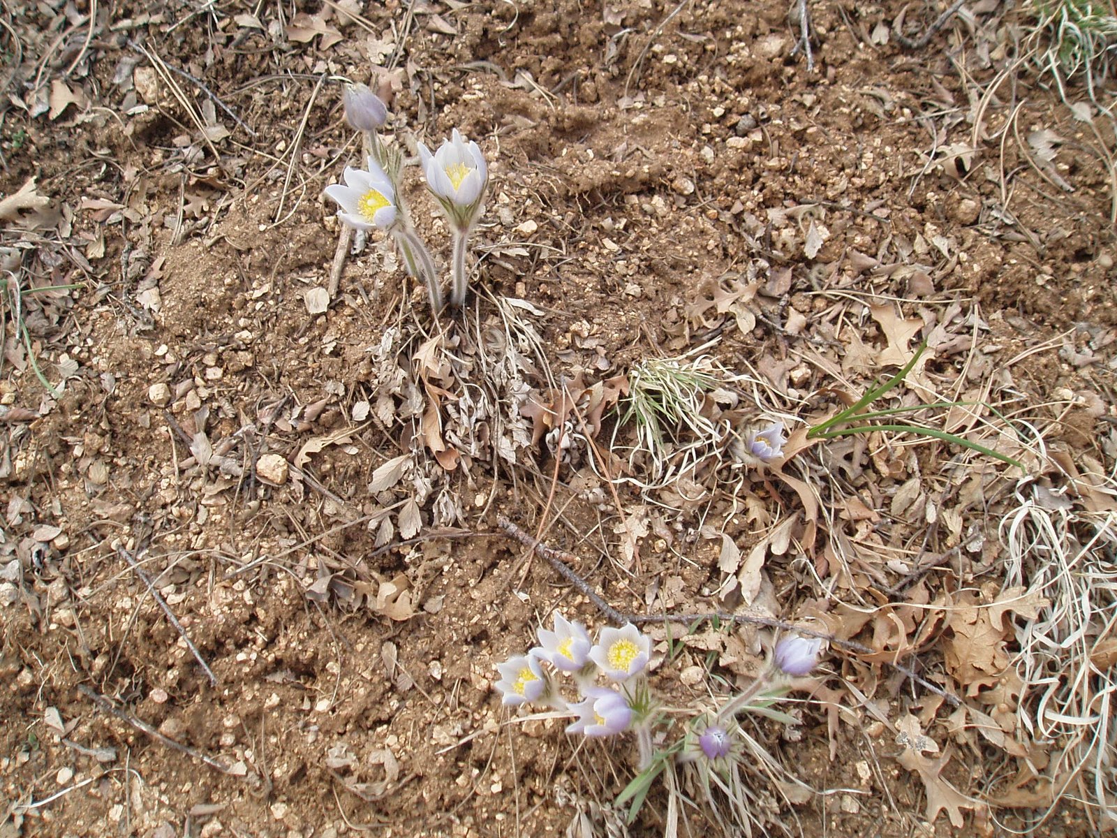
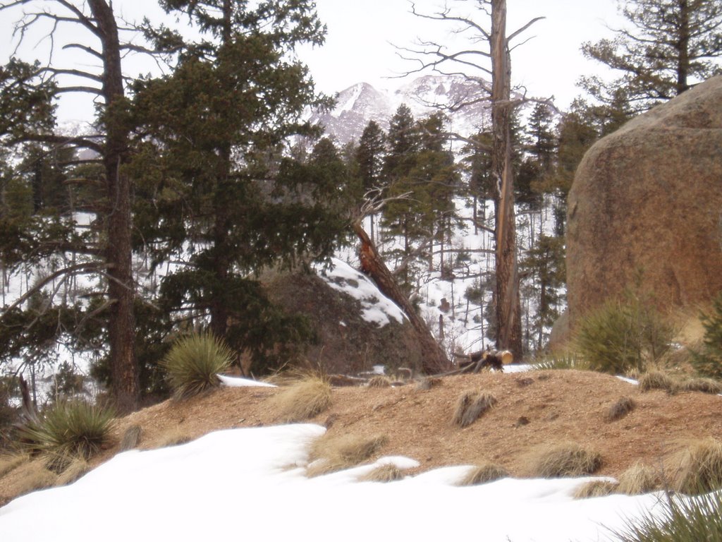
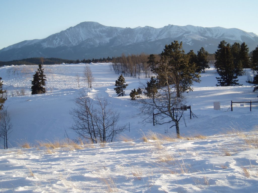
Here are some more pictures I took with my new Olympus Stylus 750 camera when I hiked the Manitou Incline on Sunday.
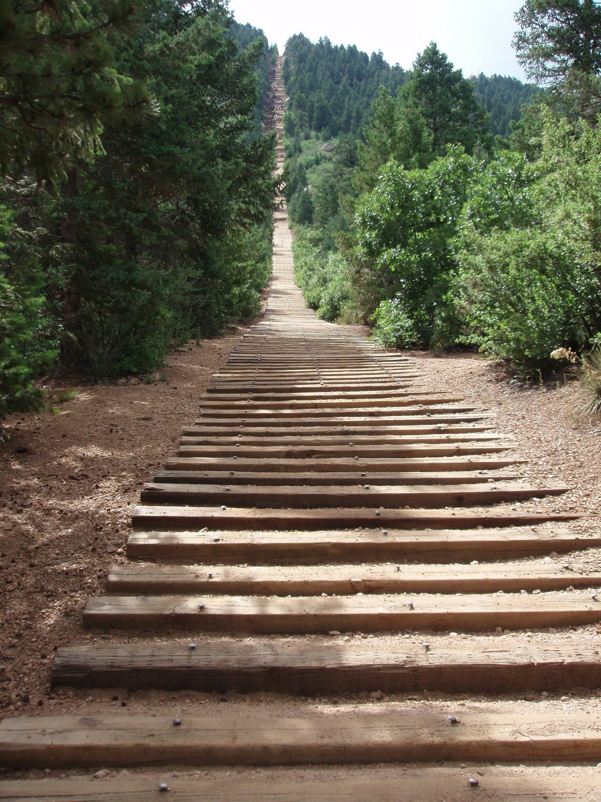

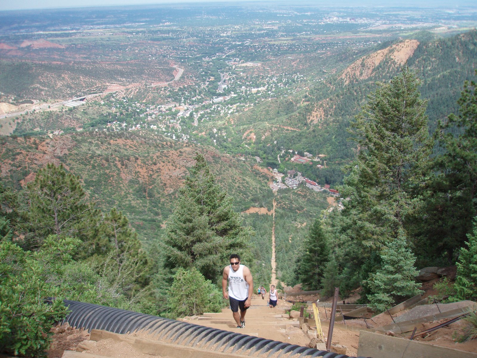
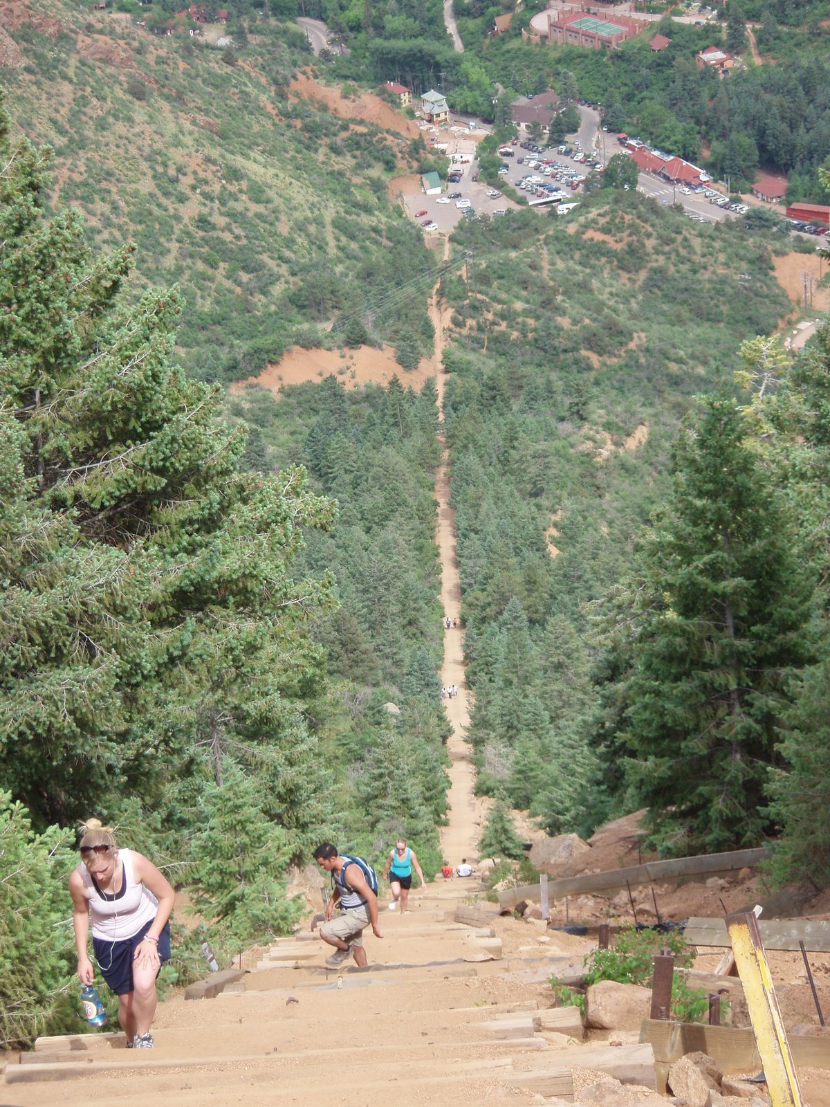
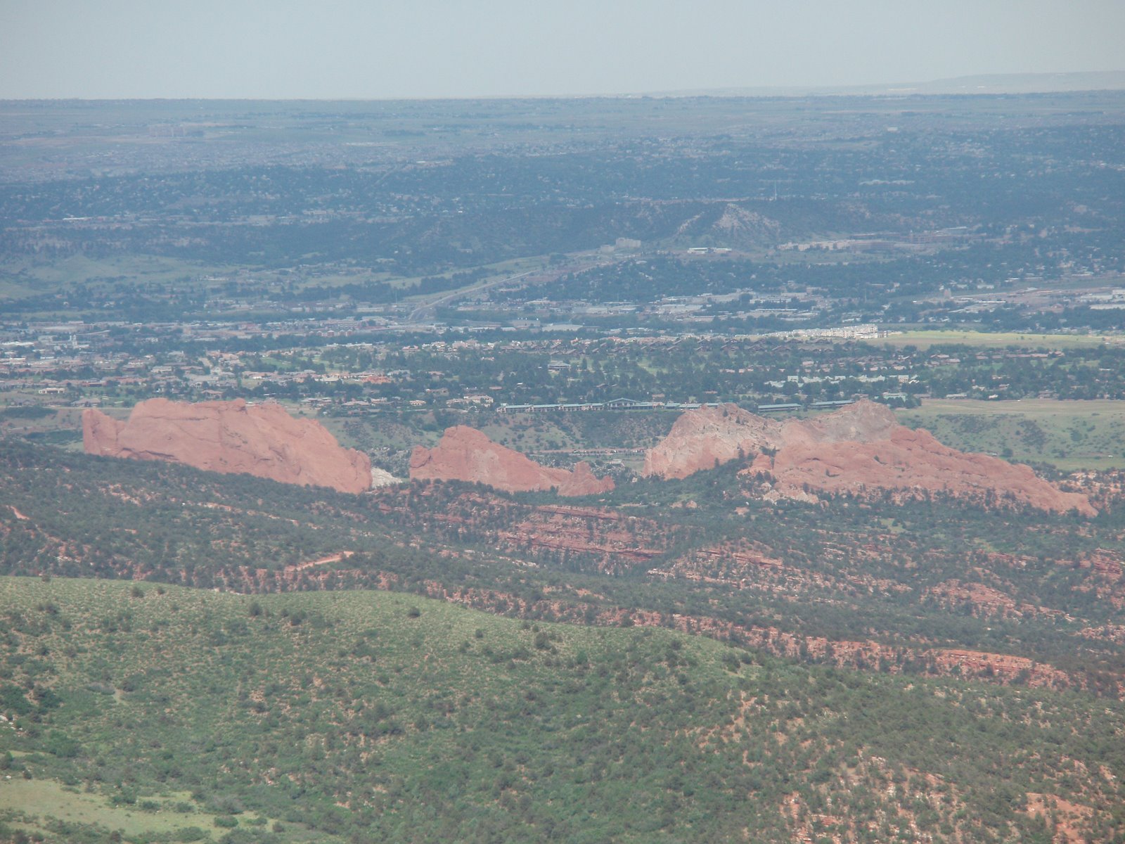
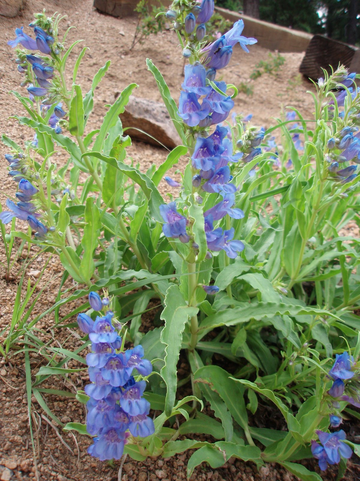
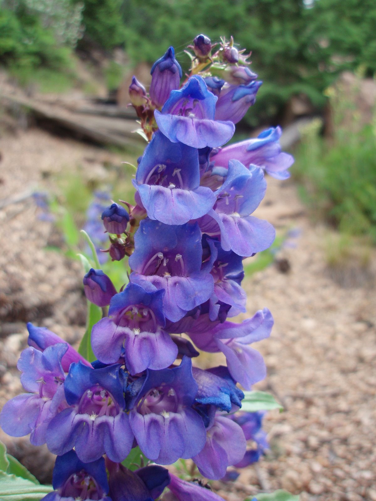


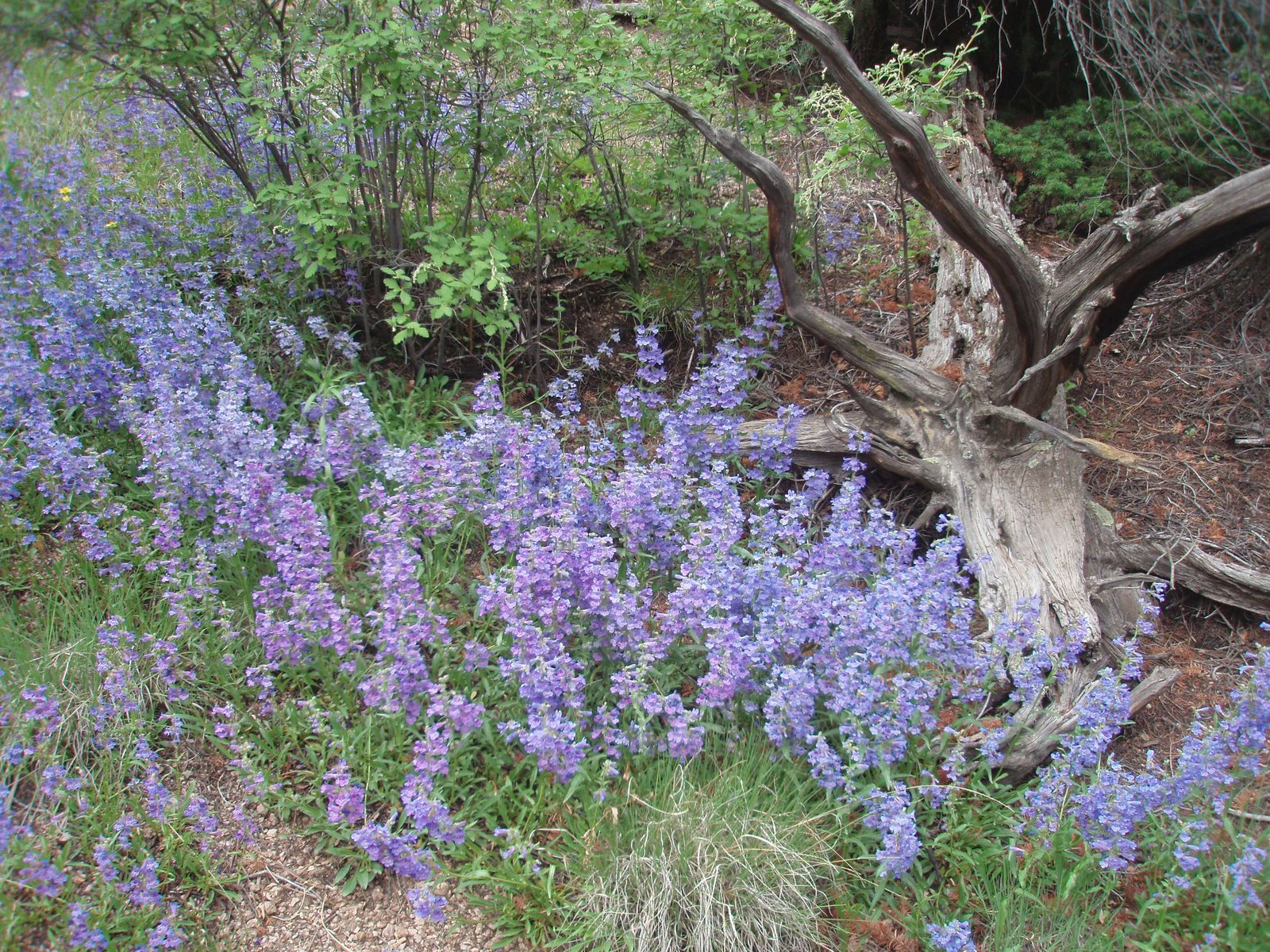
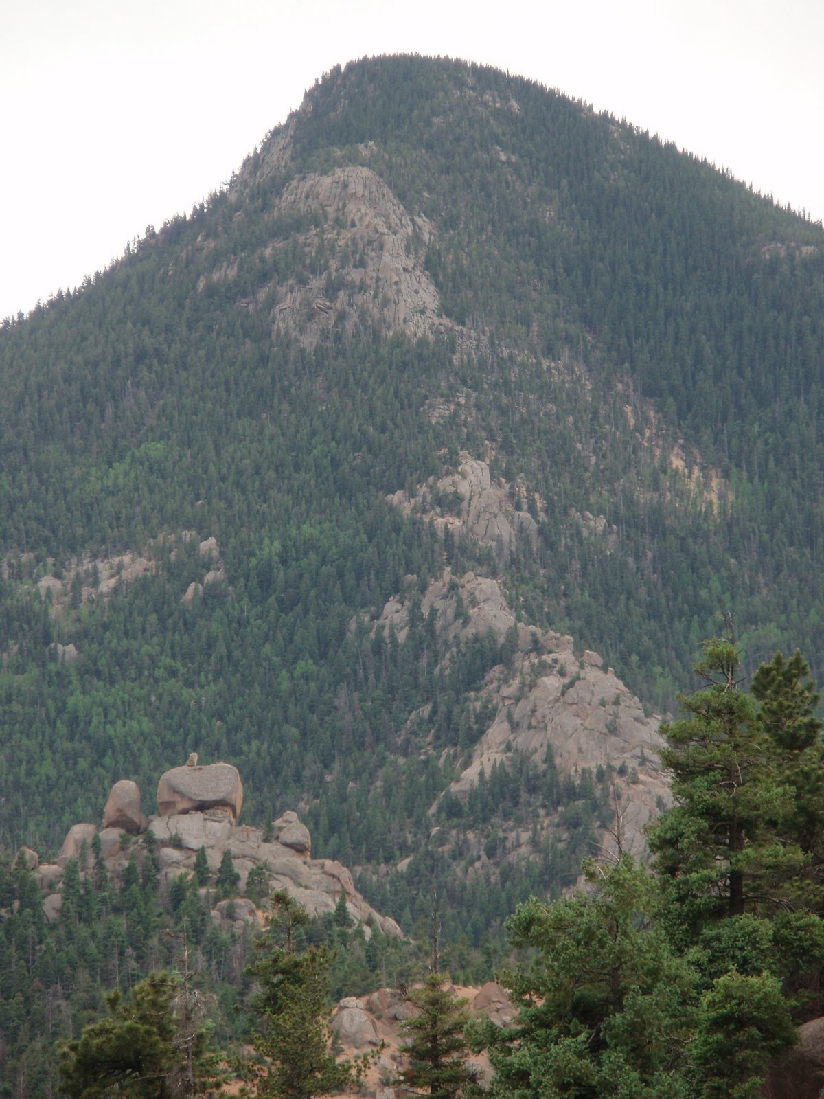

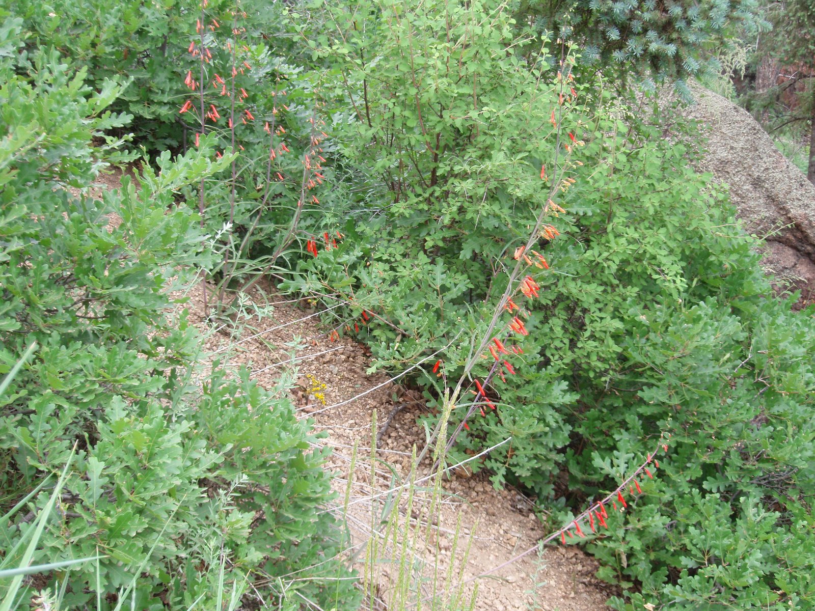
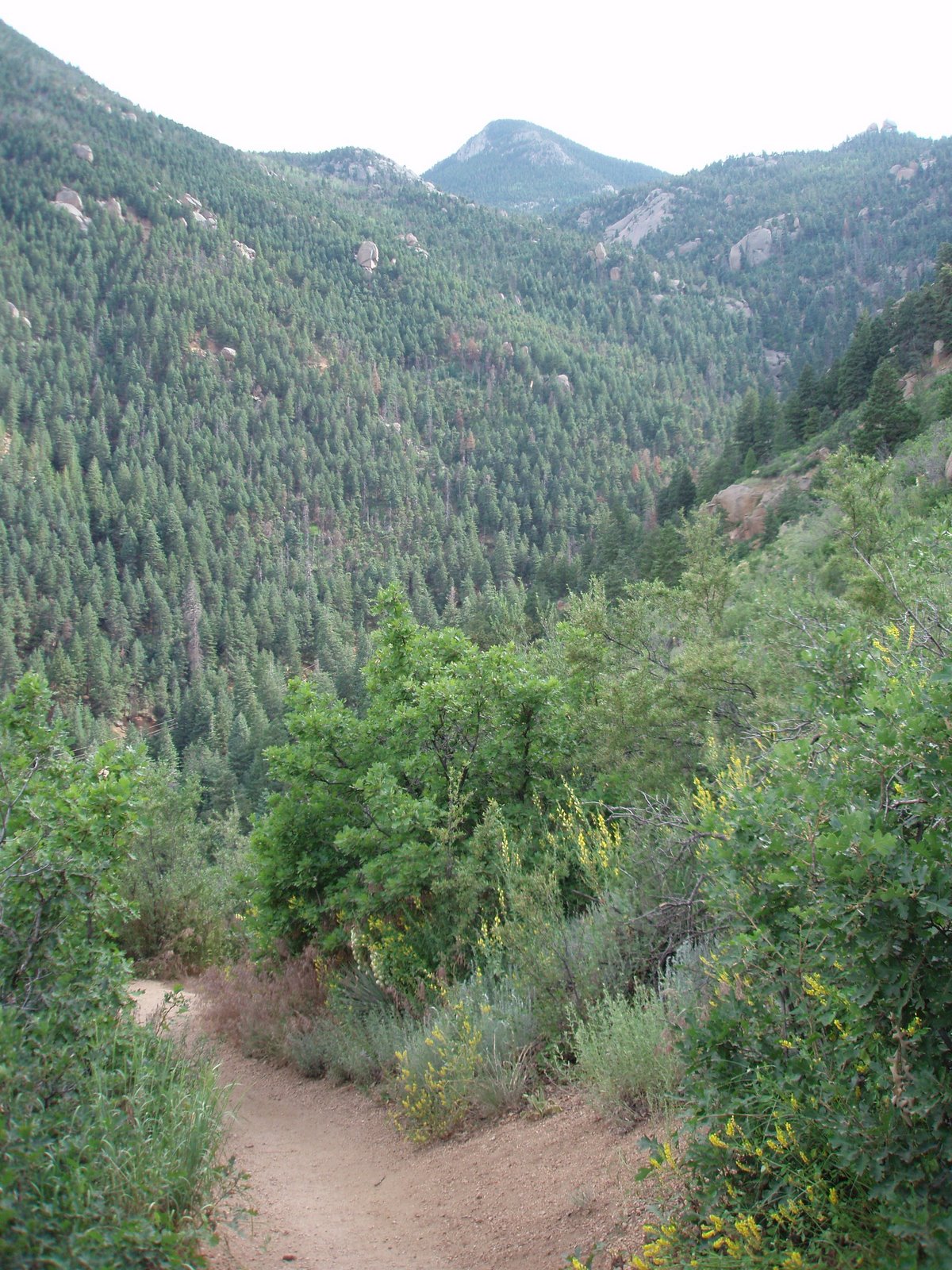
Here are some more pictures I took with my new Olympus Stylus 750 camera when I hiked the Manitou Incline on Sunday.
Yesterday’s Gazette had an article from the AP about Dave Buschow who died last July while taking a survival training course in Utah. For some reason I couldn’t find the Gazette online version but I found it on another website.
When it happened last summer, I never could find many details on it. Even with what I could find it seemed like the course instructors had pushed Dave too far. I generally believe that people are responsible for what happens to them. There are a lot of risks in life whether you’re in the backcountry or not. Sometimes bad things happen and they aren’t someone elses fault. In some cases it’s because someone made a bad decision but they thought it was the right decision when they made it. I’ve certainly done that.
There was a post on out there last July about who’s responsible for risks in various outdoor activities. The article was in response to Dave’s death. On it I commented
In the case of the guy asking for water and not being given it, I don’t know all the details but that seems like a bad thing on the part of the instructor. I can see limiting food but water isn’t something you can survive long without. I could be convinced that in this case the instructor and the school are at fault.
After reading the article, I was more than convinced the instructors were at fault. I was outraged at their actions. The temperature was around 100 degrees. The group found water around 8:30 in the morning. They drank from the water but weren’t allowed to put any in bottles to carry with them. The idea was they could only drink when they found water. Although they tried to find water throughout the day, they never found any.
Dave got to the point of falling down and the others in the group had trouble getting him back to his feet. At one point he mistook a tree for a person. His tongue was swollen. He would hurry off in the wrong direction. Finally around 7 PM over 10 hours after last drinking water, the group got to a cave with a pool of water. Dave fell again less than a 100 yards from the water. He said he couldn’t continue but the instructor with him kept telling him he could make it. Dave quit breathing and the group was unable to revive him. It turns out the instructor had emergency water in his pack.
I just can’t imagine going that long without drinking even in cool conditions let alone in that kind of heat. It’s one thing to push people to exhaustion from long days of hiking or from lack of food but not from lack of water. It was also the 2nd day of a 28 day course. It takes time to acclimate to the dry desert air and the heat. Dave was from New Jersey so I’m sure he wasn’t used to the dryness. Before I’ve done long bike races in the desert, I’ve done heat training in my bathroom.
I’ve done up to week long backpacking trips by myself in the Superstition Mountains and the Grand Canyon. I’ve almost been out of water when I’ve found more. Only once was I out of water for a couple hours before finding more. The temperature was only around 60 degrees. I was making a loop and I knew I could cut to where I had gotten water a couple days before. That would have probably meant 6-7 hours without water. For the couple hours before I found water, finding water was about the only thing I thought about. I can’t imagine what I would have been thinking after over 10 hours without water in 100 degree weather.
|
|
|
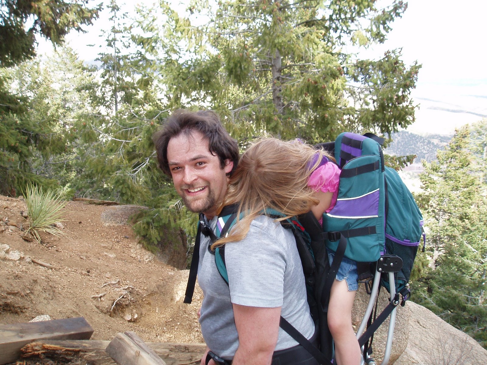
The last few times I’ve done the Manitou Incline, I’ve taken Danielle along. She just turned 4 a couple weeks ago. Sometimes she hikes quite a long ways and other times she doesn’t make it very far. The best she’s done going up is to the Barr Trail cut-off which is about 2/3 of the way. I think that’s quite impressive since that’s a ways up the steep section. She might have made it a little farther but she cut her leg on a stake trying to pull herself up one of the really big steps. She has hiked all the way down Barr Trail from the top of the Incline but that time she had slept most of the way up.
As hard as it is, I’d rather carry her up in the Kelty pack than going down the trail. Between her and the pack, it’s about 45 pounds and my knees get hammered on the way down. Last week she slept for a while on the way down. She was bouncing all over even though I was trying to walk carefully which strained my knees more than normal. See my post from a month ago to see her fast asleep in the pack.

|
|
|
During the last couple weeks we’ve had some really nice weather. This weekend it was in the 70’s which is about 20 degrees warmer than normal. I had a few things I wanted to get done on the house but I also wanted to take advantage of the weather.
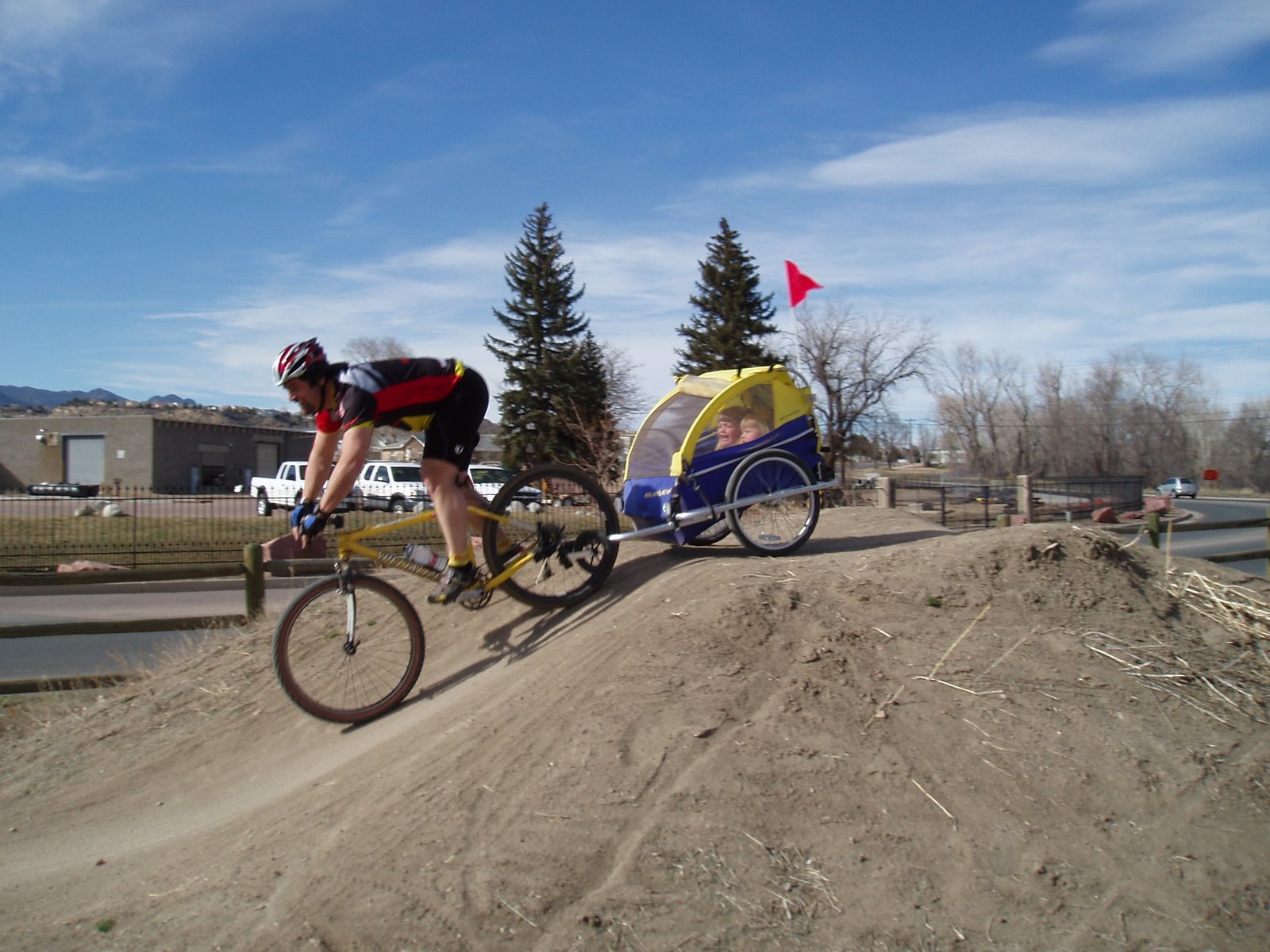
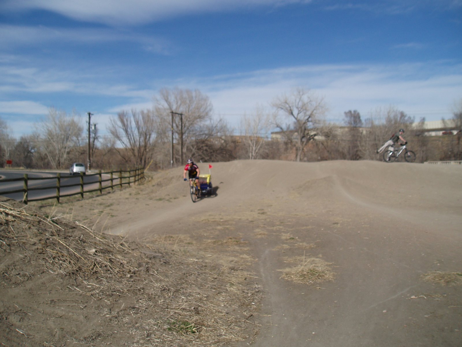 Danielle, my almost 4 year old, had been wanting me to take her in the bike trailer. She was wanting to go over the “big bumps” which means the BMX jumps by the bike path along Mark Dabling. Cassidy wanted to go too but she hates the “big jumps”. Danielle talked Julie into coming too. I hadn’t been on the jumps recently but the 3 on the north end have always been rideable pulling the Burley although they make me a little nervous. The Burley seems really well designed and stable. I don’t it would be smart to take less well made trailers over the them. This time the I found the BMXers had dug out the top of the 3rd and biggest jump. I caught a pedal and something caught on the Burley but I thought stopping could be worse than riding it out. Fortunately I stayed upright and the trailer didn’t tip.
We rode up to Ice Lake and let the kids get their feet wet. On the way back home, Danielle wanted to do the jumps again. Cassidy wasn’t about to go over them again so Julie held her while I did them a couple times. I don’t think that’s much over 14 miles round trip but pulling an extra 70 pounds made it feel longer.
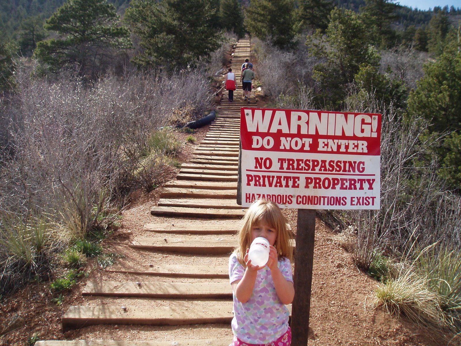
 At lot of times, I do the old Manitou Incline on Sunday afternoon because we go to my parents for lunch. The live almost to Manitou so it reduces my driving. Every time I go, Danielle has been begging to hike it with me. I decided to take her along since it was such a nice day and with the extra daylight we could take our time. It wasn’t very far until she said she was tired. She actually had good reason to be tired. It was the neighbor boy’s birthday and she had ridden 1 1/2 miles to a park and played for a couple hours.
 I coaxed her along until we got to the Cog’s No Trespassing sign and then I put her in the Kelty pack. For a few minutes, I kept hearing about how we were nearly to the top. I knew much better. After a bit there was silence and soon her head fell on my shoulder. She snored most of the way up. I’ve never taken over an hour and my best time has been 29 minutes. Sunday it took me almost an hour and 15 minutes. It’s amazing what nearly an extra 40 pounds will do on something like that.
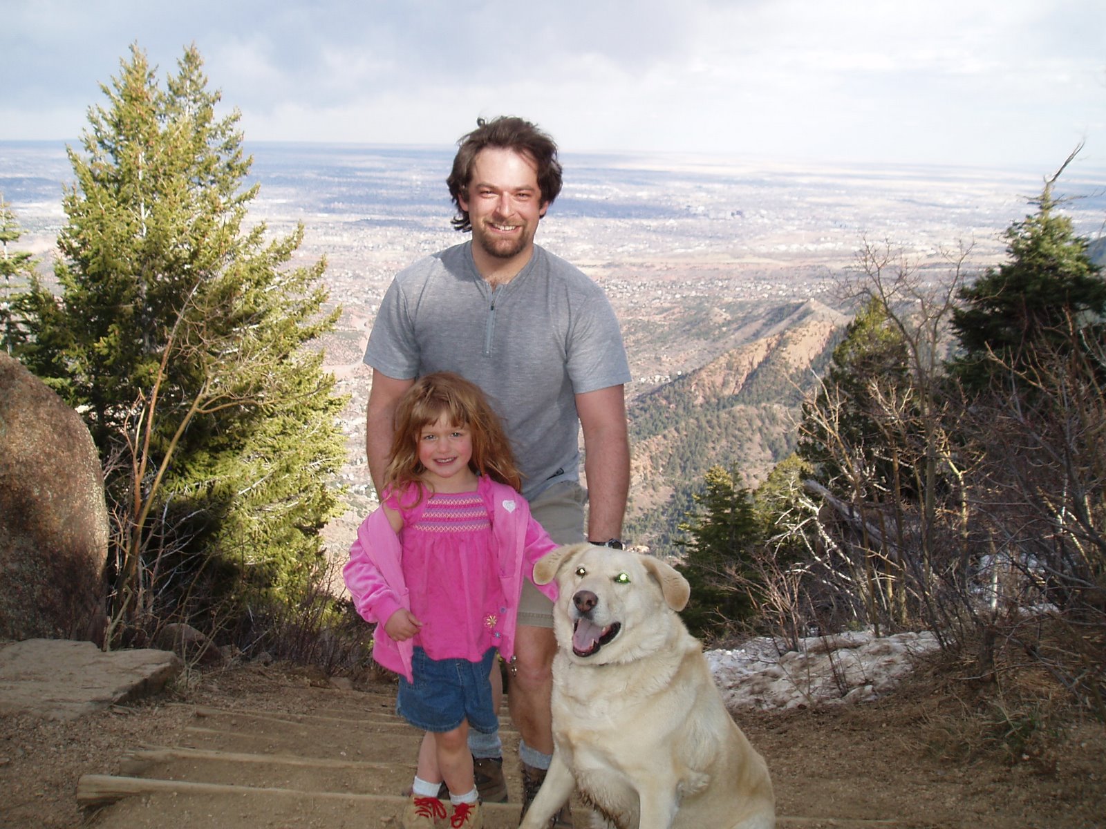 As soon as we got to the top, Danielle woke up and was full of energy. She was having fun running around and climbing on the rocks. It’s about 2 1/2 miles down Barr Trail to the trailhead. She ended up hiking the whole way down! Actually she ran more than she hiked. About a mile from the bottom, we meet Julie coming up with Cassidy. Cassidy wanted me to carry her so I got some more backpacking training.
|
|
|
The local meeting on the Pike and San Isabel National Forests management plan is tonight. This meeting was scheduled because people were turned away from the meeting in Black Forest a month ago. About 50 cars were turned away from that meeting because there wasn’t enough parking. Tonight’s location should be able to handle enough people. The meeting is from 5:30 – 9:00 PM at the DoubleTree – World Arena, 1775 E. Cheyenne Mountain Blvd.
Unfortunately I’m not going to be able to make it. If you can’t make it but want to give your opinion, you can use the Need for Change Workshop Individual Worksheet. It says it has to be submitted by March 2nd which has already passed but since they’re having the meeting tonight I’d think you could still send it in.
|
|
|
Thursday night was the 2nd Colorado Springs Watershed Access Meeting. At the first meeting on February 6th, Colorado Springs Utilities (CSU) had said there would be no access to the South Slope of Pikes Peak which has been off-limits since 1913. Several groups had been working with CSU to be able to complete the last section of the 60-mile Ring the Peak Trail and one other trail through that area.
I had planned on going to Thursday’s meeting but I’ve been sick this week. Wednesday I came home from work early and slept for over 4 hours. I crawled out of bed and lay on the couch for a little over an hour before going back to bed for the night.
City Council members and the mayor and have had discussions with CSU officials and they now have promised to allow “accommodating recreational activity”. They outlined a process for creating trails in areas that have long been off limits with trail planning starting this spring. I think this is good news although there weren’t many details. Fishermen weren’t happy since they’ve been wanting the reservoirs opened to fishing and that doesn’t seem part of the plan. I think there should be trail access through the area away from reservoirs but I don’t want vehicle access to the area. The easier the access the more people that will go. The biggest thing though is people that will hike 5 miles to get somewhere generally leave less trash and take better care of an area than those that will only walk a 100 yards.
Related Links:
|
|
|
After people were turned away from the Pike and San Isabel Forest Management Plan meeting a couple weeks ago, the National Forest promised to schedule another meeting in the Colorado Springs area. They’ve made good on their promise and have scheduled a meeting for March 6th. It will be held from 5:30 PM to 9:00 PM at the Doubletree Hotel – World Arena, 1775 E. Cheyenne Mountain Blvd.
The revision to Management Plan for the Pike and San Isabel National Forests isn’t the only issue that could affect trail access in the Pikes Peak region. The other issue is the Colorado Springs Watershed Access Policy. Not only would it affect mountain bikers but all trail users. Two meetings will be held this month and the first is tomorrow night from 6-8 PM. The next meeting will be Thursday, February 22 from 6-8 PM. Both meetings will be at the Leon Young Service Center.
The draft policy was presented to the public on November 28th, 2006. The Gazette had an article about it on December 13. At the meeting a map was shown that had 3 different zones on it. Zone 1 has no public access, Zone 2 has trail corridor access only and Zone 3 has limited public access. It’s a little hard for me to figure out exactly where the boundaries of the zones are on the map since there’s not much detail. In any case Zone 1 was drawn to not only include Coloraod Springs Utilities (CSU) property but big sections of Pike National Forest Land. Some of these areas include popular mountain biking and hiking trails. It seems that areas around the Forester Trail and Jones Park, the old Manitou Incline, Camerons Cone, etc. could be in restricted areas.
Jim Yount wrote the following in an e-mail to the Medicine Wheel Group
Scott Campbell of CSU has stated that the map was misunderstood and frustrating to those at the 1st meeting and that it is being revised for the 2nd public meeting. The revision will supposedly zone only CSU land (not National Forest) and he also has stated that the placing of Zone 2 corridors is ongoing and that all “accepted use” trails on CSU property will have Zone 2 corridors around them. However, CSU does manage National Forest Land, so they still might restrict access on land coincident with the first map but just not tell you that during the public process because it is separate from the Watershed Access Plan (I’m not a cynic!).
However, it is up to us to ensure that the trails we love are Zone 2 and not simply leave it up to CSU to define “accepted use.” For example, he stated that official (numbered, like 701 for example) Forest Service Trails are “accepted use,” as is Barr Trail, but that we shouldn’t expect “social” trails to become Zone 2.
Although the South Slope watershed has been off-limts since 1913, several groups have worked with CSU and the Forest Service to come with a Pikes Peak Master Plan. It included two trails through the South Slope. One would connect the last 4.5 miles of the 60-mile Ring the Peak trail and the other one would connect Cheyenne Canon area trails with Barr Camp. I’d like to see those trails happen although I think it’s good to have some of the South Slope restricted. I want the area to be protected and no more roads built. I don’t think it’s necessary though to make parts of the South Slope and west of Pikes Peak into a wildernes area like the Central Colorado Wilderness Coalition wants. As part of their Wilderness and Mountain Biking Guide, IMBA has a section on how to preserve areas like this without banning mountain bikes.
Update: Mostly final Pikes Peak South Slope Plan was presented on April 27th, 2010
|
|
|


 Blog RSS Feed
 Like on Facebook
 Follow on Twitter
 Flickr
 Contact