Fonk asked in a comment on my Avon to Glenwood ride last weekend about the directions. By the Fonk was my crew chief for the Race Across America so a big thanks to him for using so much of his vacation to help me attempt to ride across the country.
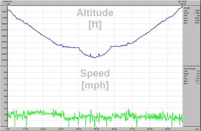
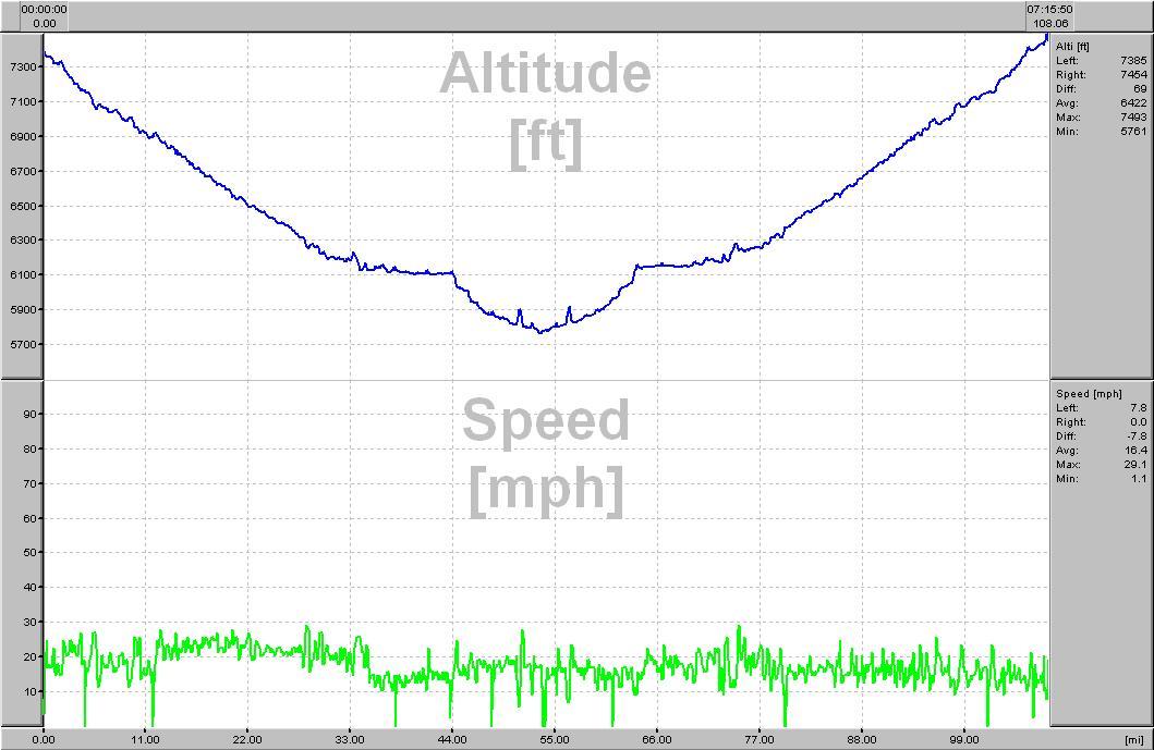
I rode from Avon to Glenwood Springs last spring while training for RAAM. It was the first time I had done that ride. When I was training for the Fireweed 400 (I need to put more than the elevation profile on that page) in 2003, I had done a big Memorial Day training weekend. I had done the Iron Horse Classic from Durango to Silverton. I then rode on to my aunt and uncle’s house in Grand Junction and spent the night there. Then I attempted to ride on to Leadville which included the section between Glenwood Springs and Avon. I ended up bailing on Battle Mountain. It was getting late and I had ridden in rain for awhile and my rear shifter cable was sticking. I dealt with it until I started climbing up Battle Mountain and then every time I stood up it would skip. Anyway I got about 170 miles the first day and 150 miles the 2nd day.
Alright so back to directions on how to do the ride. We were staying right by the I-70 exit for Avon. I’m not sure the name of the street but it’s only a few blocks and a couple round abouts from there over to US 6. Most of US 6 doesn’t have much traffic but a few sections have a moderate amount. You stay on US 6 all the way to Dotsero. Just before Dotsero, US 6 goes under I-70 to the north side. Dotsero is just a few buildings so don’t expect much. Once you get past Dotsero US 6 becomes part of I-70. This is where the Colorado River comes in from the north. Just after crossing the river, the main road turns right and begins climbing. To get to the bike path, you need to continue straight on the frontage road. I think it’s probably a little under a mile from that intersection before the road ends. There’s a small parking lot with bathrooms.
The bike path through Glenwood Canyon starts from the parking lot. Once you’re on the bike path you really don’t have an option to go much of anywhere else. Although you’re right by I-70, it’s not as noisy as you might expect. In most places the highway is above you so you don’t hear the traffic as much. I’ve really liked Glenwood Canyon since I was a little kid. I think a big part of it was from hiking up to Hanging Lake. It is an amazing spot and a hike worth doing in the area. If you took a lock and some running shoes, you could do it as part of riding the bike path.
Just before you get to Glenwood Springs, you go through a tiny town called No Name. You actually climb up rather steeply from the river there and then descend back down to the river. Once you descend back down, you go around an I-70 tunnel. Once around the tunnel you go over I-70 on a bridge and come out by the vapor caves and hot springs.
There’s a little bike shop right after you come off the bike and it’s in the Hotel Colorado. They have only a small selection of parts and accessories but they rent bikes. Just a block down the street is Mountain Sports Outlet.
The small shop didn’t have threaded CO2 cartridges and I’d used both of mine helping someone on the bike path. I don’t carry a pump so I wanted to get at least one before I headed back. He had a pump but the rubber seal seemed to have dried out over the winter. The first time I inflated his tire, it wasn’t seated right on the rim and blew out so I used my 2nd one. Mountain Sports Outlet still had a lot of ski and snowboard gear out but they also had a fairly good cycling selection too. I walked in and a guy asked me what I needed. He was very friendly and took me to where the CO2 cartridges were. They had both threaded and non-threaded CO2 and at a good price.
To get back to Avon or start the ride in Glenwood, just head back the other direction. The only potentially tricky spot on the way back is where you cross back to the south side of I-70 near Dotsero. That does appear to be the main road but you can also go straight on a frontage road that I believe eventually dead ends.


 Blog RSS Feed
 Like on Facebook
 Follow on Twitter
 Flickr
 Contact
