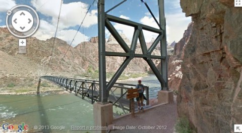
Back in October Google had posted on their blog that they had a team hiking in the Grand Canyon to get imagery for Street View. I figured they were just doing a couple of the main trails. They now have 75 miles of trails and surrounding roads live in Google Maps.
The Google team their Android-operated Trekkers to take the imagery. They carried 40-pound backpacks with the 15-lens camera system. More than 9,500 panoramas are now available on Google Maps.
In 2006 and 2008 I did week long backpacking trips in the Grand Canyon. I went west farther than most people go for the first trip. The trail was hard to find and I didn’t see anyone for 3 days. The 2nd trip I hiked the eastern part of the Grand Canyon and even went a little east of where the National Park ends.
I can tell you there’s no way to comprehend the size of the canyon looking at a computer screen. Still I have to say what Google has done is pretty cool.
Some cool places to check out are the bridge across the Colorado River to Phantom Canyon, Bright Angel Trail, South Kaibab Trail and the Meteor Crater. Maybe those will motivate you to take an adventure of your own in the Grand Canyon.
|
|
|
Tags: Google Maps, Grand Canyon, hiking


 Blog RSS Feed
 Like on Facebook
 Follow on Twitter
 Flickr
 Contact

Leave a Reply