|
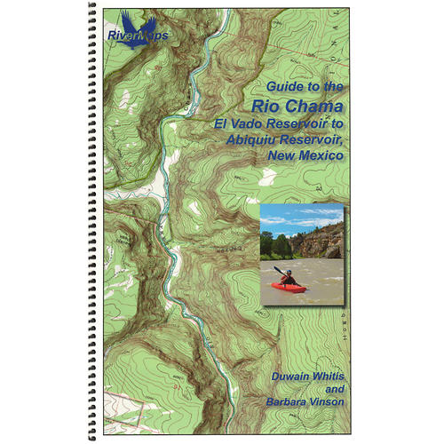
The RiverMapsTM Guide to the Rio Chama is the go to mile by mile guide for planning a trip and navigating the Rio Chama, one of the major tributaries of the Rio Grande. Flowing through scenic canyons in northwestern New Mexico, the Rio Chama is forgiving enough for the less experienced but challenging enough to keep the experienced boater's attention. Covers 31 miles of the Rio Chama from put in at Cooper's El Vado Ranch to the Big Eddy takeout. The first 25 miles of the Rio Chama featured in this guide are designated Wild Scenic. Permit requirements and regulations are included. Despite its relatively short length, The Rio Chama is one of the more hydrologically altered rivers in the western U.S., and this guide offers recommended minimum flows among other tips. Spiral bound format with full color topo maps on the right side and complete text descriptions on the facing page. Excellent mile by mile information on rapids, campgrounds, geological features, historical sites and reference points. The topo maps are the same scale as the original USGS maps. The contour lines and accurate shape of the river really help you keep track of where you are. The high quality waterproof paper won't tear and the ink won't bleed even after going through the harshest rapids. Authors: Duwain Whitis Barbara Vinson Copyright: 2017 Size: 9 x 14 Pages: 23
|


 Blog Feed
 Follow on Twitter
 Become a Facebook Fan
 Flickr
 MySpace