|
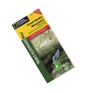
National Geographic's Trails Illustrated topographical maps, based on USGS information, are designed to take you into the wilderness and back. They show all trails, campsites, and recreational features, plus relevant information on wildlife history, geology, and archaeology. The most comprehensive and complete recreational map for GlacierWaterton National Park. Printed on waterproof, tear resistant material with a plastic coating that offers supreme durability. Dimensions: 4 x 9 inches folded 28 x 32 inches fully opened. 1989 edition, revised 2000 scale: 1:63,360 1:83,333.
|


 Blog Feed
 Follow on Twitter
 Become a Facebook Fan
 Flickr
 MySpace