|
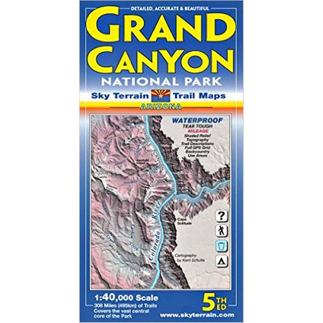
Some well known points mapped include Bright Angel Trail, Cape Royal, Cape Solitude, Desert View, Grandview Point, Cape Final, Walhalla Plateau, Colorado River, Hermit Gorge, Tower of Ra, Shiva Temple, Point Sublime, North Rim, South Rim, Kaibab Trail, Tonto Trail, Grand Canyon Village, Yavapai Point, Mather Point, Phantom Ranch, Granite Gorge, Crystal Rapids, Silver Bridge, Hopi Wall, Zoroaster Temple and oh so much more. Please note this map covers the core of the Park, the area where 99% of Park visitors travel, and where 90% of backcountry trips take place. Most trails and water sources are in this mapped area. The map shows 308,000 acres of huge country. It does not cover the far western or northern reaches of the Park.
|


 Blog Feed
 Follow on Twitter
 Become a Facebook Fan
 Flickr
 MySpace