|
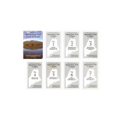
This guide covers 281 miles, from Katahdin in Baxter State Park to the New Hampshire state line. A must for through hikers, it includes a guidebook plus topographical and profile maps that are tear and water resistant. 156 page softcover book 14th edition 2004 size: 4 12 x 6 12 inches. Seven multicolor topographic maps, with elevation profiles scale: 1:62,500. In this set only, trail descriptions appear on the backs of the maps.. Map 1: Katahdin to South End of Nahmakanta Lake Map 2: Nahmakanta Lake to West Branch of the Pleasant River. Map 3: West Branch of the Pleasant River to Monson Map 4: Monson to the Kennebec River. Map 5: Kennebec River to Maine Highway 27 Map 6: Maine Highway 27 to Maine Highway 27. Map 7: Maine Highway 27 to Maine Highway 17.
|


 Blog Feed
 Follow on Twitter
 Become a Facebook Fan
 Flickr
 MySpace