|
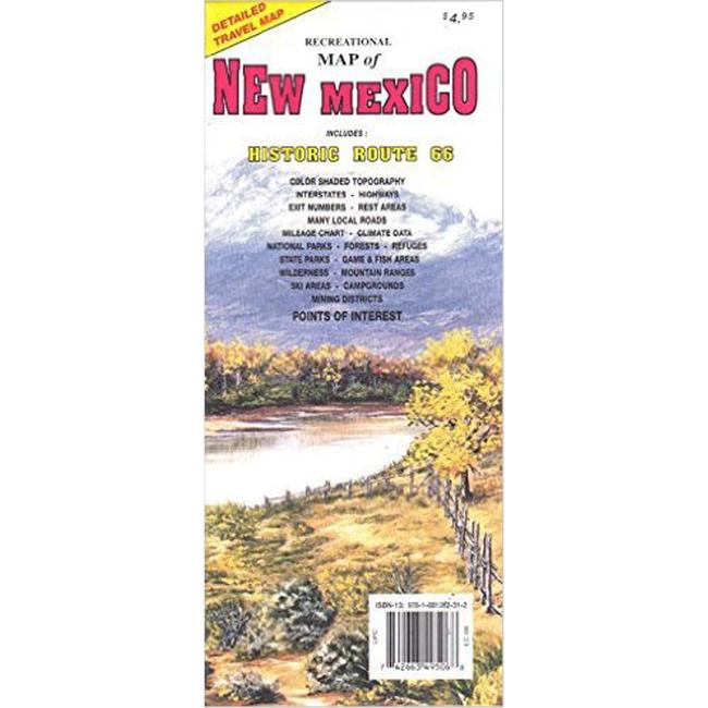
Topographic Recreational Map of New MexicoTopographic Recreational Map of NEW MEXICO is a detailed travel map featuring Interstates, exit numbers, highways, and more local roads than typical road maps. US ROUTE 66 is highlighted. Topographic contours are 1,000 feet each with color shading each 2,000 feet above 6,000 feet. Features include national forests, wildernesses, campgrounds, parks, state game fish areas, ski areas, mining districts, points of interest, and more.
|
| Merchant | Price | Regular Price | |
|---|---|---|---|
| Summit Hut | $4.95 | $4.95 |
Copy the following string into an e-mail to support@ultrarob.com to request support.
Mozilla/5.0 AppleWebKit/537.36 (KHTML, like Gecko; compatible; ClaudeBot/1.0; +claudebot@anthropic.com)
Email: web@ultrarob.com
 Blog Feed
 Follow on Twitter
 Become a Facebook Fan
 Flickr
 MySpace
Similar Gear
| ||
| ||
| ||
| ||
|