|
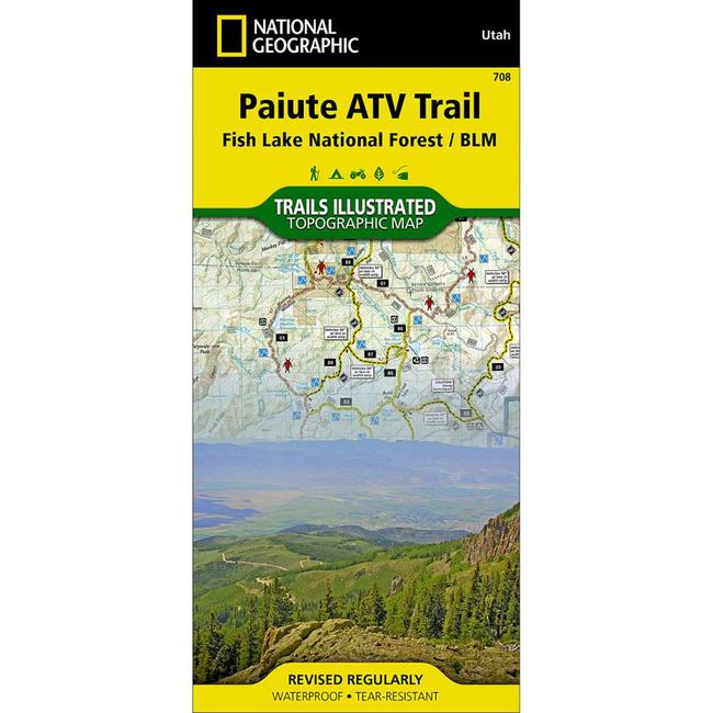
This National Geographic Trails Illustrated topographic map is the most comprehensive recreational map for Utah's Paiute ATV Trail. Coverage includes: Fishlake National Forest BLM Sevier River Resource Area Millard, Sevier and Paiute counties complete map of Paiute ATV Trail with adjoining loop trails and town access maps Fillmore Richfield Koosharem Marysvale Geenwich and Circleville. Piute, Otter Creek, Rocky Ford, Koosharem and Three Creeks reservoirs are also included.More than just a map, National Geographic Trails Illustrated topographic maps are designed to take you into the wilderness and back. Printed on tear resistant, waterproof material, this map can go anywhere you do. Each map is based on exact reproductions of USGS topographic map information, updated, customized, and enhanced to meet the unique features of each area. The maps include valuable wilderness tips and Leave No Trace guidelines, along with updated trails, trailheads, points of interest, campgrounds, and much more. With a new color palette and stunning shaded relief, backcountry navigation has never been easier.
|


 Blog Feed
 Follow on Twitter
 Become a Facebook Fan
 Flickr
 MySpace