|
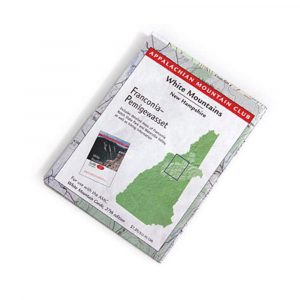
Take AMC's White Mountains Guide maps with you on the trail. Full color contour maps created using GIS technology are pocket size versions of the contour maps printed in their hiking guides. Side 1: White Mountain National Forest, NH ME scale: 1:95,000. Side 2: Detailed maps of Franconia Notch State Park and Waterville Valley scale: 1:47,520, plus hiking information. Printed on waterproof, tear resistant Tyvek for great durability. Dimensions: 3 58 x 4 34 inches folded 18 x 24 inches fully opened. 2003 edition 2 of AMC's White Mountains maps for use with AMC White Mountain Guide, 27th edition.
|


 Blog Feed
 Follow on Twitter
 Become a Facebook Fan
 Flickr
 MySpace